Timeline of the 2004 Pacific hurricane season
[nb 2][2][3] Persisting throughout the season was an area of atmospheric and oceanic conditions hostile to tropical cyclones, including below-average sea surface temperatures and a stable air mass.
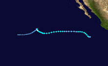
[nb 3][5] Impacts on land were unusually light during the season, largely on account of the aforementioned ridge steering the vast majority of tropical cyclones out to sea.
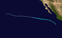
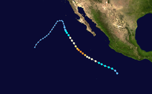
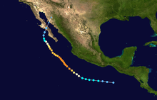
[10][11] In mid-October, Tropical Storm Lester caused rainfall of up to 5 in (130 mm) in southern Mexico when it passed close to the coast.
Figures for maximum sustained winds and position estimates are rounded to the nearest five units (knots, miles, or kilometers) and averaged over one minute, following National Hurricane Center practice.
This timeline documents the formation of tropical cyclones as well as the strengthening, weakening, landfalls, extratropical transitions, and dissipations during the season.