Toney Mountain
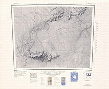
Toney Mountain (75°48′S 115°49′W / 75.800°S 115.817°W / -75.800; -115.817 (Toney Mountain)) is an elongated snow-covered shield volcano, 38 nautical miles (70 km; 44 mi) long and rising to 3,595 metres (11,795 ft) at Richmond Peak, located 35 nautical miles (65 km; 40 mi) southwest of Kohler Range in Marie Byrd Land, Antarctica.
[11] That the mountain is mostly ice covered makes it difficult to determine its composition, the origin of the elongated shape of the volcano and the volcanological relation between the parasitic cinder cones and the main volcanic pile.
[12] On the other hand, it is also possible that growing ice sheets during this period compressed magma chambers and thus triggered explosive eruptions.
[14] Toney Mountain lies in Marie Byrd Land, a tectonically and volcanically active region of Antarctica.
There, a layer of basaltic rocks up to 5 km (3.1 mi) thick underlie a series of felsic volcanic edifices.
These basaltic rocks in turn are emplaced above a Paleozoic basement with granite intrusions of Devonian-Cretaceous, which crops out in some mountain ranges.
[8] Toney Mountain was probably among those viewed from a distance by Admiral Richard E. Byrd and others of the United States Antarctic Service (USAS) in plane flights from the ship Bear in February 1940.
It was named after George R. Toney, scientific leader at Byrd Station in 1957, a participant in several Antarctic and Arctic operations, serving in both field and administrative capacities.
Named by US-ACAN for Homer L. Ellis, ACC, United States Navy, radar air traffic controller at McMurdo Station, winter party 1968, and chief in charge of the ground controlled approach unit at the Byrd Station skiway landing strip, summer season, 1969–70.
Named by US-ACAN for Bill S. Downs, AC1, United States Navy, Air Controlman at Williams Field near McMurdo Station in the 1969–70 and 1970-71 austral summers.
A cirque marked by a sheer rock cliff located just west of Zum Peak along the central-north wall of Toney Mountain.
Named by US-ACAN for John H. Roberts III, United States Navy, Chief Commissaryman with the South Pole Station winter party, 1974.
A cliff about 6 nautical miles (11 km; 6.9 mi) east-northeast of Richmond Peak on the north side of Toney Mountain.
Named by US-ACAN for Lieutenant Patrick E. Creehan, MC, United States Navy Reserve, Flight Surgeon of Squadron VXE-6 during Operation Deep Freeze 1971 and 1972.
A rock 2.5 nautical miles (4.6 km; 2.9 mi) east of Cox Bluff on the mainly snow-covered Spitz Ridge in eastern Toney Mountain massif.
Named by US-ACAN for Charles E. Nicholson, CE2, United States Navy, Construction Electrician at South Pole Station, 1974.
Named by US-ACAN for Richard D. Gillett, RM1, United States Navy, Radioman at South Pole Station, 1974.