Taurus Mountains
Heinrich Kiepert writes in Lehrbuch der alten Geographie that the name was borrowed into Ancient Greek from the Semitic (Old Aramaic) root טורא (ṭūrā), meaning "mountain".
In the Aladaglar and Bolkar mountains, limestone has eroded to form karstic landscapes of waterfalls, underground rivers, and some of the largest caves of Asia.
[5] At lower elevations, the predominant vegetation forest and woodland of evergreen oaks and Turkish pine (Pinus brutia), and areas of maquis shrubland.
Above 1200 meters elevation are montane forests of black pine (Pinus nigra), Lebanon cedar (Cedrus libani), Taurus fir (Abies cilicica), and juniper (Juniperus spp.).
[6] Torrential thunderstorms in these mountains were deemed by the ancient Syrians to be the work of the storm-god Adad to make the Tigris and Euphrates rivers rise and flood and thereby fertilise their land.
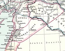
[9] In the Second Temple period, Jewish authors seeking to establish with greater precision the geographical definition of the Promised Land, began to construe Mount Hor as a reference to the Amanus range of the Taurus Mountains, which marked the northern limit of the Syrian plain.
[10] During World War I, the German and Turkish railway system through the Taurus Mountains proved to be a major strategic objective of the Allies.
This region was specifically mentioned as a strategically controlled objective slated for surrender to the Allies in the Armistice, which ended hostilities against the Ottoman Empire.