Tropical Storm Gabrielle (2007)
The seventh named storm of the 2007 Atlantic hurricane season, Gabrielle developed as a subtropical cyclone on September 8 about 385 miles (620 km) southeast of Cape Lookout, North Carolina.
On September 9, Gabrielle made landfall at Cape Lookout National Seashore in the Outer Banks of North Carolina with winds of 60 mph (97 km/h).
In advance of the storm, tropical cyclone watches and warnings were issued for coastal areas, while rescue teams and the U.S. Coast Guard were put on standby.
Interaction with an upper-level trough resulted in moderate wind shear which suppressed further development,[5] and by September 6 the thunderstorm activity lost much organization.
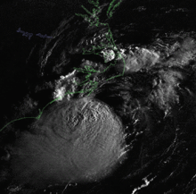
Subsequent to the flight, the center became slightly better organized, and based on the large wind field and the presence of an upper-level low to its west-southwest, the National Hurricane Center classified the system as Subtropical Storm Gabrielle early on September 8 while located about 385 miles (620 km) southeast of Cape Lookout, North Carolina.
Based on evidence of a weak warm-core, the system was re-designated as Tropical Storm Gabrielle late on September 8 about 185 miles (298 km) southeast of Cape Lookout, North Carolina.
[11] Vertical wind shear decreased as the storm passed over the Gulf Stream, allowing a strong convective burst to develop near the center.
[16] Gabrielle weakened to a tropical depression shortly thereafter,[17] and maintained scattered convection despite unfavorable wind shear as it tracked along the northern portion of the Gulf Stream.
[18] By midday on September 11, the circulation had become ill-defined and elongated; failing to meet the criteria of a tropical cyclone, the National Hurricane Center declared Gabrielle dissipating well to the south of Nova Scotia.
[23] Prior to the arrival of the storm, the National Park Service closed visitor centers and campgrounds along the Outer Banks.
[31] Forecasters predicted rough surf and rip currents, prompting the Coast Guard to perform preparations in the Northeastern United States.
[23] Sustained winds of tropical storm force occurred along the coastline, unofficially reaching 44 miles per hour (71 km/h) at Frisco.
[37] The passage of the storm left a portion of North Carolina Highway 12 on Hatteras Island closed for three hours, briefly flooding part of the road.

Tropical storm (39–73 mph, 63–118 km/h)
Category 1 (74–95 mph, 119–153 km/h)
Category 2 (96–110 mph, 154–177 km/h)
Category 3 (111–129 mph, 178–208 km/h)
Category 4 (130–156 mph, 209–251 km/h)
Category 5 (≥157 mph, ≥252 km/h)
Unknown