Tropical cyclone basins
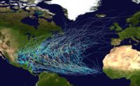
The United States National Hurricane Center (NHC) monitors the basin and issues reports, watches and warnings about tropical weather systems for the Atlantic Basin as one of the Regional Specialized Meteorological Centres for tropical cyclones as defined by the World Meteorological Organization.
The hurricane season runs between May 15 and November 30 each year, and encompasses the vast majority of tropical cyclone activity in the region.
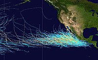
[12] Storms that form here often affect western Mexico, and less commonly the Continental United States (in particular California), or northern Central America.
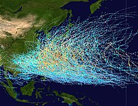
[6][needs update] The basin occupies all the territory north of the equator and west of the International Date Line, including the South China Sea.
[18] Tropical storms in this region often affect China, Hong Kong, Japan, the Koreas, Macau, Philippines, Taiwan and Vietnam, plus numerous Oceanian islands such as Guam, the Northern Marianas and Palau.
[23] High shear explains why no cyclones can form in the Red Sea, which possesses the necessary depth, vorticity and surface temperatures year-round.
Although the geographical dimensions of tropical oceans and the Mediterranean Sea are clearly different, the precursor mechanisms of these perturbations, based on the air-sea thermodynamic imbalance, are similar.
[27][28] The 1995 system developed a well-defined eye, and a ship recorded 140 km/h (87 mph) winds, along with an atmospheric pressure of 975 hPa.
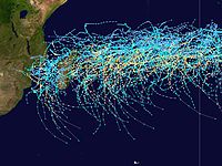
[29] Within the Southern Hemisphere tropical cyclones generally form on a regular basis between the African coast and the middle of the South Pacific.
For various reasons including where tropical cyclones form, there are several different ways to split the area between the American and African coasts.
The United States Joint Typhoon Warning Center also monitors the whole region, but splits it at 135°E into the South Pacific and the Southern Indian Ocean.
[30] Until the start of the 1985–86 tropical cyclone season the basin only extended to 80°E, with the 10 degrees between 80 and 90E considered to be a part of the Australian region.
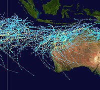
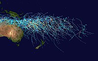
[35] The South Pacific Ocean basin runs between 160°E and 120°W, with tropical cyclones developing in it officially monitored by the Fiji Meteorological Service and New Zealand's MetService.
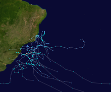
However, beginning in 2011, the Brazilian Navy Hydrographic Center started to assign names to tropical and subtropical systems in this basin, when they have sustained wind speeds of at least 65 km/h (40 mph).