Tyumen
Founded in 1586 to support Russia's eastward expansion, the city has remained one of the most important industrial and economic centers east of the Ural Mountains.
Located at the junction of several important trade routes and with easy access to navigable waterways, Tyumen rapidly developed from a small military settlement to a large commercial and industrial city.
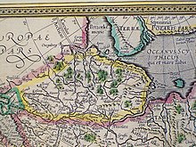
The Cossack ataman Yermak Timofeyevich conquered the Tyumen area, originally part of the Siberia Khanate, for the Tsardom of Russia in 1585.
Sibir was never rebuilt - though it gave its name to all concurrent and future lands in North Asia annexed by Russia - but Tyumen was later re-founded.
On July 29, 1586,[2] Tsar Feodor I ordered two regional commanders, Vasily Borisov-Sukin and Ivan Myasnoy, to construct a fortress on the site of the former Siberian Tatar town of Chingi-Tura ("city of Chingis"), also known as Tyumen, from the Turkic and Mongol word for "ten thousand"[15] – tumen.
The military situation meant that streltsy and Cossack garrisons stationed in the town predominated in the population of Tyumen until the mid-17th century.
By the beginning of the 18th century, Tyumen had developed into an important center of trade between Siberia and China to the east and Central Russia to the west.
A influx of prisoners-of-war from the Swedish army which surrendered after the Battle of Poltava in 1709 arrived in Tyumen - some of them settled permanently.
Early in the Russian Civil War in 1917, forces loyal to Admiral Alexander Kolchak and his Siberian White Army controlled Tyumen.
In the winter of 1941, twenty-two major industrial enterprises evacuated to Tyumen from the European part of the Soviet Union.
[22] As the result of this economic and population boom, with tens of thousands of skilled workers arriving from across the Soviet Union between 1963 and 1985, the rapid growth of the city also brought a host of problems.
Its social infrastructure was limited and the lack of city-planning has resulted in uneven development, with which Tyumen has continued to struggle.
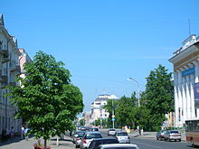
[27] Historically, Tyumen occupied a small area on the high bank of the Tura River around the foundation site of the city.
When viewed from above, present-day Tyumen appears to be a collection of low-rise towns with occasional clusters of tall buildings.
Low bank Dormitories is a cluster of standard 9-storey buildings was built on reclaimed land east of Bukharskaya Sloboda – Zareka and Vatutina.
The Old Dormitories area features standard five-storey blocks of flats constructed in the 1960s and 1970s at the west and east extremities of the city.
The New Dormitories area features clusters of standard tall buildings constructed after 1980 at the south and south-east edges of Tyumen.
However, when the Trans-Siberian Railway arrived at the end of the 19th century, the town's rate of population growth was greatly boosted.
[citation needed] In the 1960s, the discovery of the rich oil and gas fields in Western Siberia caused the city's population, which had not been forecast to exceed 250,000 inhabitants that decade, to swell to almost half a million.
[13] While the population of Tyumen includes people from over a hundred different ethnicities, most belong to one of the following ethnicities:[31] As of 2009[update], there are over ten operational Orthodox temples (both newly built and historical), two mosques (both newly built), one synagogue, and one Roman Catholic church in Tyumen (St. Joseph's Church).
[citation needed] The Church of Savior Uncreated was visited by Crown prince Alexandr (later Alexander II) during his Siberian tour.
Due to its advantageous location at the crossing of the motor, rail, water and air ways and its moderate climate Tyumen was an ideal base town for servicing the oil and gas industry of the West Siberia.
Many large oil and gas companies such as Gazprom, LUKoil, Gazpromneft and Shell have their representative offices in Tyumen.
[citation needed] At the international level, the station services passage to (Trans-Siberian Railway): Poland, Germany, China, Mongolia, and Azerbaijan.
The city's bus fleet is in process of modernization and expansion, with newly acquired Russian buses replacing the severely aged Soviet models.
[citation needed] Tyumen is served by the international Roschino Airport located 13 kilometres (8 miles) west of the city.
The city has a regular service to a large number of Russian towns, including, Moscow (9 flights a day), St. Petersburg, and Samara.
[citation needed] In addition, the road network was planned before the fall of the Soviet Union, and in its current state, it can operate normally only in the scheme which includes public transportation only.
To date, the road network serves about 200% above planned capacity, which leads to numerous traffic jams and high accident rates.
Since 2002, city and regional authorities have undertaken numerous initiatives to improve Tyumen's road network, but due to the continued growth of private automobile ownership rates, these efforts have only had short term positive effects.