U.S. Route 17 in Georgia
The portion of US 17 concurrent with I-16 and SR 404 Spur (on the Talmadge Memorial Bridge) were formerly part of US 17 Alt.
[5] The Georgia General Assembly made the Ocean Hiway designation official in a 1958 resolution that recognized the concerted advertising effort of the Ocean Hiway Association, its impact on tourism, and the signage of the highway in the coastal states to the north.
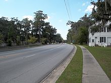
Within the city, US 17/SR 25 follows four-lane divided Bedell Avenue, which intersects SR 25 Spur (10th Street), a connector between the center of town and I-95.
The highway intersects and begins to travel concurrently with SR 110 (4th Street) within the Woodbine Historic District.
[10] US 17/SR 25 and SR 110 cross Piney Island Creek and meet the eastern terminus of SR 252 (Burnt Fort Road) at the hamlet of White Oak just south of White Oak Creek.
US 17/SR 25 curves east and enters Glynn County by crossing the Little Satilla River at Spring Bluff.
The concurrency curves north and within a suburban area has a four-way intersection with US 82/SR 520 (South Georgia Parkway) and the southern terminus of SR 303 (Blythe Island Highway).
US 17/SR 25 turns east onto four-lane divided South Georgia Parkway, here also known as Jekyll Island Road, to travel concurrently with US 82/SR 520.
The highway becomes divided again shortly before SR 520 splits east as Downing Musgrove Causeway toward Jekyll Island as US 17/SR 25 curves north to cross the Brunswick River on the cable-stayed Sidney Lanier Bridge into the city of Brunswick.
US 17/SR 25 crosses Cypress Mill Creek and leaves the city limits just south of its directional intersection with the southern terminus of SR 25 Spur (Golden Isles Parkway), which connects US 17/SR 25 with I-95.
US 17/SR 25 reduces to two lanes just north of Chapel Crossing Road to the east of the Federal Law Enforcement Training Center.
The highways reenter a rural area as they travel to the east of Brunswick Golden Isles Airport.
)/SR 99 and travels along the edge of the Hofwyl-Broadfield Plantation State Historic Site before crossing the South Altamaha River into McIntosh County.
splits west along SR 251 and US 17/SR 25 reduces to two lanes and passes Eden Field Airport.
US 17/SR 25 crosses a pair of swamps around the hamlet of Ardick and intersects SR 99 (Ridge Road) again at Eulonia.
US 17/SR 25 temporarily expands to four lanes between its crossing of the Riceboro Southern Railway, which is part of the former Seaboard Air Line corridor, and its intersection with the eastern terminus of SR 119 (E.B.
The highways meet SR 204 (Abercorn Expressway) at a diamond interchange in the suburb of Georgetown then crosses the Little Ogeechee River.
I-516/US 17/US 80/SR 21/SR 25/SR 26 and I-516's unsigned companion designation of SR 421 head north-northeast from the interchange as a four-lane freeway.
Four-lane US 17, which is also signed as SR 404 Spur, travels through another pair of partial interchanges: a northbound exit and southbound entrance for Louisville Road and a southbound exit and northbound entrance for a spur to Oglethorpe Street.
North of the latter interchange, US 17 ascends onto the cable-stayed Tallmadge Memorial Bridge, which crosses over Bay Street and the main channel of the Savannah River.
At this same time, SR 27 was established on a westward curve from St. Marys to a point northwest of Brunswick, following parts of the current path of US 17/SR 25 in this area.
In addition, an unnumbered road was built from SR 21 north-northwest of Savannah east-northeast to the South Carolina state line.
US 17 and SR 25 were extended north-northwest from Savannah to the previously-unnumbered road and then east-northeast to the South Carolina state line.
At this time, the path of SR 25 Spur in Savannah was utilized as the northbound lanes of US 17/SR 25, while US 17/SR 25 southbound used the previous routing.
[29][30] In 1966, the portion of SR 26 Loop used for US 17/SR 25 was indicated to have been under construction from Ogeechee Road to Augusta Avenue.
[41][42] In 1995, the path of US 17 between Savannah and Hardeeville, South Carolina, was shifted to the southeast, onto I-16 and SR 404 Spur, thus replacing US 17 Alt./SR 25 Alt.
This segment of highway frequently gets congested during peak hours, lacks left turn lanes, and has had a high rate of accidents in recent years.
[1][11] SR 25 has a length of 9.51 miles (15.30 km) from its split with US 17 in Savannah to the South Carolina state line in Port Wentworth.