U.S. Route 17 in Virginia
U.S. Route 17 (US 17) is a part of the United States Numbered Highway System that runs from Punta Gorda, Florida, to Winchester, Virginia.
The U.S. Highway connects the Albemarle Region of North Carolina with the Hampton Roads metropolitan area.
At Fredericksburg, US 17 leaves the Atlantic Plain; the highway passes through the Piedmont town of Warrenton and crosses the Blue Ridge Mountains on its way to Winchester in the Shenandoah Valley.
The route from Tappahannock to Winchester roughly follows the Confederate march during the Civil War to Gettysburg.
), which follows George Washington Highway through the Chesapeake community of Deep Creek, US 17 curves northeast as Dominion Boulevard and reduces to two lanes.
The highway temporarily expands to a divided highway around its intersection with State Route 165 (SR 165; Cedar Road), then crosses the Southern Branch Elizabeth River on the newly constructed Veterans Bridge, replacing the former double-leaf bascule drawbridge known commonly as the Dominion Boulevard Steel Bridge.
Just east of that intersection, US 17 enters a combination cloverleaf-directional interchange with SR 168, which heads south as the Oak Grove Connector toward the Outer Banks; Interstate 64 (I-64), which follows the southern segment of the Hampton Roads Beltway, and I-464, which heads north toward downtown Norfolk.
At Paradise Creek, SR 141 continues along George Washington Highway while US 17 turns northwest onto Frederick Boulevard.
The highway parallels a rail line through its intersection with SR 337 (Portsmouth Boulevard), then veers away from the railroad to meet I-264 at a partial cloverleaf interchange with a flyover ramp from southbound US 17 to the eastbound Interstate.
US 17 and SR 33 head north together and cross the Dragon Swamp, which becomes the Piankatank River, into Middlesex County and assume the name Tidewater Trail.
At the north end of downtown, US 360 turns east onto Queen Street to cross the Rappahannock River to the Northern Neck.
US 17 expands to a divided highway and follows the west bank of the river before heading inland again after crossing Mount Landing Creek.
The U.S. Highway passes through the communities of Caret, Champlain, Chance, and Loretto before crossing Portobogo Creek into Caroline County.
The U.S. Highway passes through Rappahannock Academy, named for a defunct military school, Moss Neck, and Olney Corner before curving west.
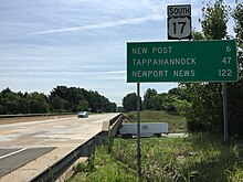
At New Post, the highway intersects SR 2, which heads south as Sandy Lane Drive toward Bowling Green and north concurrent with US 17 Bus.
US 17 crosses over CSX Transportation's RF&P Subdivision as it heads west to its junction with US 1 (Jefferson Davis Highway) at Massaponax.
North of the river in Stafford County, US 17 separates from I-95 for the last time on its entire route and receives the northern end of US 17 Bus.
[1][2] US 17 continues northwest as Warrenton Road, a four-lane divided highway that passes businesses and heads northeast of a park-and-ride lot.
The road enters more rural areas and passes through Berea, Paynes Corner, Hartwood, and Storck on its way to the Fauquier County line at Deep Run.
US 17 briefly passes through the town limits of Warrenton while heading northwest to a partial interchange with the northern end of US 17 Bus.
Just north of the partial interchange, SR 55 (John Marshall Highway) diverges from US 17 to parallel I-66 toward Front Royal.
[1][2] US 17 and US 50 become a divided highway that crosses the Blue Ridge Mountains at Ashby Gap and enters Clarke County.
Highways follow Jubal Early Drive into Winchester, then turn right onto two-lane Millwood Avenue, which crosses CSX Transportation's Shenandoah Subdivision at grade before reaching US 17's northern terminus at the intersection of Cameron and Gerrard streets at the southern edge of downtown.
[3] Work began on December 2020 to widen US 17 from a two-lane road to a four-lane divided highway between its overpass over I-95 in Fredericksburg and just east of its intersection with Hospital Blvd and Germanna Point Drive.