U.S. Route 19
Despite encroaching Interstate Highways, the route has remained a long-haul road, connecting the Gulf of Mexico with Lake Erie.
[1] The length of the highway is 1,438.2 miles (2,314.6 km), including both US 19E/US 19W paths through North Carolina and Tennessee.
US 19 runs 262 miles (422 km) along Florida's west coast from an interchange with US 41 in Memphis, south of St. Petersburg, and continues to the Georgia border north of Monticello.
According to a 2005 Dateline NBC report, part of US 19 in Florida may be the most dangerous road in the U.S. A Highway Patrol test period beginning in 1998 and ending in 2003, as mandated by the National Highway Traffic Safety Administration, showed the stretch of US 19 from Pasco to Pinellas county to average approximately 52 deaths a year, or 262 deaths in the five-year duration of the study; 100 of these deaths were pedestrian related, making US 19 the worst road to walk on in these two counties.
[11] Multiple efforts to improve US 19 have been suggested to the Florida Department of Transportation, among them, an overpass strictly for left-turn lanes.
[12] Currently, US 19 between Clearwater and St. Petersburg is getting a freeway-style upgrade due to the cancelation of an extension of I-375 in the late 1970s.
[13][14] US 19 enters Georgia just south of Thomasville as Lee Highway, concurrent with State Route 3 (SR 3).
It continues north, passing through Albany, Americus, Ellaville, Butler, Thomaston, and Zebulon.
It then turns north on Peachtree Street until it intersects with SR 141 in Buckhead and becomes Roswell Road.
US 19 and US 74 are cosigned as far as Ela, after which US 74 veers south, leaving US 19 to head into the Great Smoky Mountains.
Then, US 19 is cosigned with US 23 from Lake Junaluska to Mars Hill (and with US 70 in Asheville), which closely parallels I-40 and then Future I-26.
Just north of Mars Hill, US 19 continues solo to Cane River, where US 19 splits: US 19E toward Burnsville and US 19W toward Erwin, Tennessee.
Heading northeast, it goes through Roan Mountain, Hampton, and Elizabethton, rendezvousing with US 19W in Bluff City.
US 19 starts again in Bluff City, heading northeast along the Volunteer Parkway (and concurrency with US 11E) to Bristol.
It then heads north to Lebanon, through Clinch Mountain, then northeast again through the towns of Claypool Hill, Tazewell, and then finally to Bluefield, where it enters West Virginia.
US 19 enters West Virginia as a four-lane highway in Bluefield, where it narrows to two lanes as it winds northward.
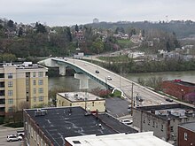
Then, it exits and reverts to a two-lane highway, more or less following the route of I-79 as it passes through Weston, Clarksburg, Fairmont, and Morgantown before crossing into Pennsylvania.
The distance from Beckley from I-79 is also known as Appalachian Development Highway System (ADHS) Corridor L. It allows traffic to the Pittsburgh, Pennsylvania, area to bypass Charleston, and is thus part of a main link from Charlotte, North Carolina, and Myrtle Beach, South Carolina, to Pittsburgh.
Passed in 1965, the purpose of the ADHS is to generate economic development in previously isolated areas, supplement the Interstate Highway System, connect Appalachia to the Interstate System, and provide access to areas within the region as well as to markets in the rest of the nation.
US 19 was extended to its southern terminus of Memphis in September 1954, when the original Sunshine Skyway Bridge opened to traffic.
Starting around 1956, US 19 was four-laned, initially in the Perry area, working north toward the Georgia border.
[20] In January 1983, after improvements to US 19A had made it similar to an Interstate Highway, the state proposed designating US 19A as US 19 Bypass.
US 19 followed today's US 11 approaching Abingdon, then used Colonial Avenue and crossed the railroad to modern US 11 at roughly the Bytt Street location, then US 58 Alt.
East of here, US 19 more closely followed it current path although in the field it appears old alignment pieces are visible to the north side.
In about 1935, according to that year's WVDOT annual report, US 19/US 21 was removed from Covington and Piney Creek roads near Raleigh (south edge of Beckley) Also, in about 1935, according to that year's WVDOT annual report, US 19/US 21 was put on new construction between Glen Jean and Oak Hill leaving behind CR 20 (now CR 21/20) from Glen Jean to Whipple Junction and CR 15 from Whipple Junction to Oak Hill.
Also, in about 1935, according to that year's WVDOT annual report, US 19/US 21 was removed from CR 21/4 (Old Court Street) north of Fayetteville.
Also, in about 1935, according to that year's WVDOT annual report, US 19 was removed from Colasessano Drive which no longer crosses Buffalo Creek to Old Pennsylvania Avenue north of Fairmont.
[24] For many years, the Venango Path was a Native American trail between the Forks of the Ohio (present day Pittsburgh) and Presque Isle Bay.
In 1987, the Phase One project started to connect two sections of Ohio River Boulevard near Western Avenue and Chateau Street.
PennDOT has started construction on a multilane roundabout at the intersection of US 6, US 19, US 322, and PA 98 in Vernon Township, near Meadville.