U.S. Route 1 in Massachusetts
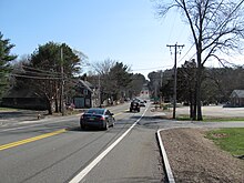
It closely parallels Interstate 95 (I-95) as it goes through the towns of North Attleborough, Plainville, Wrentham, Foxborough (where Gillette Stadium is), Walpole, Sharon, Norwood, and Westwood.
[2][3][4] From Peabody, US 1 again closely parallels I-95 going through the towns of Danvers, Topsfield, Ipswich, Rowley, Newbury, and Newburyport.
The Newburyport Turnpike opened on February 11, 1805, and was constructed by a private company at a cost of $500,000 (equivalent to $10.2 million in 2023[5]).
The turnpike was used by stagecoaches and mail carriers for decades, but toll collection ceased in 1847 as parallel railroads attracted more use.
Several sections were rebuilt to accommodate automobile traffic in the early 20th century, but it saw decreased use following the completion of I-95.
The Northeast Expressway was planned to extend north, as part of I-95, from Saugus, through Lynn, Lynnfield and Peabody.
It was among the canceled highways affected by Governor Francis Sargent's February 1970 moratorium on expressway construction within Route 128.
[10] In the late 1980s, at the request of the Metropolitan District Commission (now the Department of Conservation and Recreation) in an attempt to reduce the incidence of overheight vehicles finding their way onto Storrow Drive,[11] US 1 was moved onto I-93 south of and through Boston, leaving the old route—Veterans of Foreign Wars Parkway (VFW Parkway), Jamaicaway, Riverway, and Storrow Drive through Dedham, Chestnut Hill, West Roxbury, Jamaica Plain, and central Boston—without a number.
There are still some street signs incorrectly indicating the former alignment as US 1, and many local residents still refer to parts of VFW Parkway and Jamaicaway as "Route 1", as if it still runs along its old trajectory.
Major rock blasting would be required for the project due to a massive ledge next to the highway, and seven bridges would be replaced and three others upgraded to handle the new lanes.