U.S. Route 23 in Georgia
In Homeland, US 301/SR 23 heads northeast at an interchange into the woods of northeastern Charlton County toward Nahunta, Jesup, Claxton, Statesboro, and Sylvania, while US 23 continues to the northwest in the concurrency with US 1/SR 4/SR 15/SR 121.
Later, in Racepond, SR 15/SR 121 branch off to the northeast, while the US 1/US 23/SR 4 concurrency remains running to the northwest and then crossing into Ware County, turning straight north somewhere in Dixon Memorial State Forest.
US 1/US 23/SR 4 turns from straight north to northeast where it leaves the Alma city limits as it crosses the Curtis Lee Marion Bridge over the Hurricane Creek, resuming its former name as Alma Highway, and it then curves straight north again to cross the Jauquion R. "Rab" Tanner Bridge over the Hurricane Creek Overflow and remains that way for the next 4.1 miles (6.6 km).
Nearing Hazlehurst, Alma Highway continues into the southern terminus of US 23 Bus./SR 135 Conn., while US 23/SR 19 turns right onto Larry Contos Boulevard, taking part of US 221 Truck/SR 135 Truck with it.
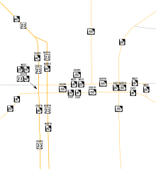
The route officially enters the Hazlehurst city limits between Currie Street and the railroad bridge over the Norfolk Southern Railway's Brunswick District.
Larry Contos Boulevard ends at US 341/SR 27 (a divided four-lane highway Designated the Golden Isles Parkway), and US 23/SR 19 turns northwest along this route.
The routes cross the Jeff Davis–Telfair county line by passing over the Dr. C. R. Youmans Memorial Bridge over the Ocmulgee River where it enters Lumber City.
The divided highway ends at a Husqvarna Group plant along the border of McRae where after the intersection with East Avenue, the route later splits onto a pair of one way streets.
US 23/US 341/SR 27 tries to curve more toward the north but still remains northwest as it eventually enters Eastman where US 23 leaves US 341 onto two-lane wide College Street, but has another concurrency with US 341 Bus.
North of a cemetery near the city limits, the name of the street changes from Oak Street to Eastman Cochran Highway but still remains two lanes wide from that point on, although construction is underway on widening the road to a four-lane highway (partially divided, partially with a center turn lane) between SR 87 Conn. north of Eastman to the community of Empire at the Dodge–Bleckley county line.
US 23/US 129 Alt./SR 87 remains an undivided four-lane highway through the Twiggs County line to the intersection with SR 96 in Tarversville, then narrows down to two lanes for the next 24 miles (39 km).
From there, US 23/SR 87 passes by the National Register of Historic Places (NRHP)-listed Rose Hill Cemetery as it descends toward a bridge over I-75 at the interchange with SR 540 and the western terminus of I-16 but has no connecting ramps to or from either highway.
Aside from two gravel mines owned by Vulcan Materials Company, the route encounter little else until reaching a traffic circle with SR 18 (Dames Ferry Road).
North of Bethlehem Road, US 23/SR 42 climbs an embankment for a bridge over the railroad line it frequently encountered and now runs along the east side of those tracks.
Further north after the intersection with King Mill Road, it gains the name Macon Street and passes by a pair of now closed warehouses.
Both streets enter the McDonough Historic District where they encounter another one-way pair with SR 20/SR 81, the westbound segment of this having a one-block overlap with southbound US 23/SR 42.
The north side of this district, as well as the rest of McDonough Square, is dominated by the Henry County Courthouse, which runs along westbound SR 20/SR 81 and spans between northbound and southbound US 23.
After a Henry County fire station, it narrows down to two lanes before approaching a powerline right-of-way and a bridge over Little Cotton Indian Creek and later curves toward the north.
Just west of the Stockbridge City Hall and former site of the Walden-Turner House, US 23/SR 42/SR 138 runs above a bridge over the same railroad line it encountered near Flovilla, Jackson, and Locust Grove.
The Main Gate to Fort Gillem can be found across from Anvil Block Road, the southeast corner of which includes a warehouse that serves as the beginning of an industrial trend along the routes, mostly involving trucking companies.
Within the community, an extraordinarily large number of trucking companies and related businesses are gathered around or near US 23, even as that and SR 42 cross the DeKalb County line, where the name Moreland Avenue continues.
Along this segment, the road runs over a railroad bridge and then passes by the Moreland Flea Market and later the Chestnut Hill Cemetery and Starlight Six Drive-In Theatre just before the southeastern terminus of SR 42 Spur.
On the Poncey–Highland – Atkins Park neighborhood line, US 23 turns east on US 29/US 78/US 278/SR 8/SR 10 (Ponce de Leon Avenue), while SR 42 continues north along Briarcliff Road.
This pattern ends at Lullwater and Fairview roads but is repeated again shortly afterward at Shady Side and Dellwood parks, where the routes enter Druid Hills.
On the opposite side, a North Ponce de Leon Avenue runs along the northern edge of Deepdene Park while US 23/US 29/US 78/SR 8 runs along the south side of that park, but US 278/SR 10 branches off to the southeast toward East Lake, Kensington, I-20 from Lithonia to Covington, and ultimately to Hilton Head Island in South Carolina, only for North Ponce de Leon Avenue to reunite with its parent street.
After crossing under a stone arch railroad bridge and entering Decatur, Ponce de Leon Avenue becomes a local street, while US 23/US 29/US 78/SR 8 branches off to the northeast onto Scott Boulevard.
Entering North Decatur, the street name changes to Clairmont Road and eventually approaches I-85 at exit 91, where US 23/SR 155 crosses the Brookhaven city line.
Though signed only for Sprout Springs Road, the Rankin Smith Interchange (exit 12) in Flowery Branch also includes Phil Niekro Boulevard.
Most intersections from that point on are strictly local street built at-grade; however, a single connecting ramp from both directions of US 23/US 441 runs down to the southwest corner of the bridge over the southern terminus of SR 197.
From there, it passes through the Blue Ridge Mountain communities of Wiley, Lakemont, and Tiger, the divider comes to an end and US 23/US 441/SR 15 remains undivided through the rest of the state with either three or four lanes as it enters Clayton.