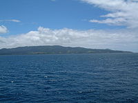
Vanua Levu
The Fiji Platform lies in a zone bordered with active extension fault lines around which most of the shallow earthquakes were centred.
The Pliocene Undu Group in the northeastern portion of the island, consists of breccia, tuff, and flows of rhyolite and dacite overlain by pumiceous strata.
The Plio-Pleistocene Mba Grouop is found on the southwestern portion of the island and consists of porphyritic basalt flows and volcanoclastics grading into greywacke.
Northern Vanua Levu, by contrast, has a dry climate eight months of the year, enabling sugar cane, the island's major crop, to thrive there.
The Important Bird Area covers the largest tracts of the remaining old-growth forest on the peninsula, which is on the south of Vanua Levu, and supports a population of the vulnerable shy ground doves.
[4] The island's main population centres are the towns of Labasa, in the north, and Savusavu, located at the foot of the peninsula.
For administrative purposes, Vanua Levu is divided into three provinces: Bua (in the west), Macuata (in the north-east), and Cakaudrove (in the south-east).
Together with the remote Lau Islands, Vanua Levu and its outliers form the Tovata Confederacy, one of three traditional alliances of Fiji's chiefs.
Vanua Levu was settled about 3,100 years ago, with the settlers living in houses raised above the reefs on the shores.
He was followed by Captain William Bligh in 1789, en route to Timor while escaping from the Mutiny on the Bounty, in which his crew had forced him and those loyal to him off deck and cast them adrift in a launch.
Traders began exploiting sandalwood thickets in the Bua Bay area around 1805, which had been discovered by shipwrecked sailors of the schooner Argo.
In March 2012, the country of Kiribati began negotiating to buy 5,000 acres (2,023 hectares) of the island to house its population, which is expected to need to move as their territory is inundated by rising sea levels.