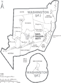
Washington County, Rhode Island
[4] Rhode Island counties have no governmental functions other than as court administrative boundaries, which are part of the state government.
[5] The area today known as Washington County was part of the ancestral lands of the Narragansett Indian Tribe.
[6] During the second half of the 17th Century, about a dozen English colonists from Newport and Massachusetts colonies moved to the area to establish farms; the larger of these were known as "Narragansett Planters.
Early land purchases in the Narragansett Country were effected by settlers after the establishment of Indian trading posts at Fort Neck in Charlestown, and at Smith's Castle in Wickford.
The borders of the Narragansett country were disputed for nearly 100 years among the colonies of Rhode Island, Connecticut, and Massachusetts.
The county's topography ranges from flat along the shoreline to gently rolling hills farther inland.
As of the 2010 United States Census, there were 126,979 people, 49,177 households, and 32,297 families residing in the county.