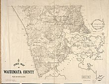
West Auckland, New Zealand
Later industries developed around kauri gum digging, orchards, vineyards and the clay brickworks of the estuaries of the Waitematā Harbour, most notably at New Lynn on the Whau River.
[7] This border originally existed much earlier than, as the rohe marker between Te Kawerau ā Maki and Tāmaki isthmus iwi.
[8] Avondale and Blockhouse Bay are east of the Whau River on the Auckland isthmus, but are included in the definition due to their strong historical ties.
[10][11][12] Occasionally a stricter definition of West Auckland is used in reports and scientific literature, which includes just the Henderson-Massey, Waitākere Ranges and Whau local board areas.
[13][14][15] The traditional Tāmaki Māori names for the area include Hikurangi, Waitākere, Whakatū and Te Wao Nui a Tiriwa.
[32] Similar to the word bogan, the stereotype usually involves a macho, working class Pākehā with poor taste, and the mullet haircut.
[2] The Westie sub-culture was depicted in the New Zealand television series Outrageous Fortune (2005–2010), with particular attention to the distinctive fashion, musical preferences and interest in cars typical of this social group.
[35][better source needed] Twenty-two million years ago, due to subduction of the Pacific Plate, most of the Auckland region was lowered 2,000–3,000 metres (6,600–9,800 ft) below sea level, forming a sedimentary basin.
[37] The volcano is the largest stratovolcano in the geologic history of New Zealand, over 50 kilometres (31 mi) in diameter and reaching an estimated height of 4,000 metres (13,000 ft) above the sea floor.
[38] Between 3 and 5 million years ago, tectonic forces uplifted the Waitākere Ranges and central Auckland, while subsiding the Manukau and inner Waitematā harbours.
[36] The modern topography of West Auckland began to form approximately 8,000 years ago when the sea level rose at the end of the Last Glacial maximum.
[40] Prior to this, the Manukau and Waitematā harbours were forested river valleys,[40] and the Tasman Sea shoreline was over 20 kilometres (12 mi) west of its current location.
[46] The Waitākere Ranges are known for the wide variety of fern species (over 110),[46] as well as native orchids, many of which self-established from seeds carried by winds from the east coast of Australia.
[47] The areas of West Auckland close to the Waitematā Harbour, such as Henderson, Te Atatū Peninsula and Whenuapai, were formerly covered in broadleaf forest, predominantly kahikatea, pukatea trees, and a thick growth of nīkau palms.
[51] The catchments of the Te Wai-o-Pareira / Henderson Creek and the Whau River are home to marine species including the New Zealand longfin eel, banded kōkopu, common galaxias (īnanga) and the freshwater crab Amarinus lacustris.
[55] One of the earliest individuals associated with the area is Tiriwa, a chief of the supernatural Tūrehu people, who is involved with the traditional story of the creation of Rangitoto Island, by uplifting it from Karekare on the west coast.
[61][62] Instead of living in permanent settlements, Te Kawerau ā Maki and other earlier Tāmaki Māori groups seasonally migrated across the region.
[63] The west coast was well known for its abundant seafood and productive soil, where crops such as kūmara, taro, hue (calabash/bottle gourd) and aruhe could be grown, and for the diversity of birds, eels, crayfish and berries found in the ranges.
[64] Archaeological investigations of middens show evidence of regional trade between different early Māori peoples, including pipi, cockles and mud-snail shells not native to the area.
[62][19] Defensive pā and kāinga (villages) were found close to the portages and the major walking tracks across the area, including at the Opanuku Stream and the Huruhuru Creek.
[19][66] In the early 1600s, members of Ngāti Awa from the Kawhia Harbour, most notably the rangatira Maki and his brother Matāhu, migrated north to the Tāmaki Makaurau region, where they had ancestral ties.
[76] The earliest permanent European settlement in the Auckland region was the Cornwallis, which was settled in 1835 by Australian timber merchant Thomas Mitchell.
Helped by William White of the English Wesleyan Mission, Mitchell negotiated with the chief Āpihai Te Kawau of Ngāti Whātua for the purchase of 40,000 acres (16,000 ha) of land in West Auckland on the shores of the Manukau Harbour.
[77] Symonds formed a company to create a large-scale settlement at Cornwallis focused on logging, trading and shipping, subdividing 220 plots of land in the area.
The native forest left a strong impression on residents who lived in these communities, and was one of the major factors that sparked the campaign for the Waitākere Ranges to become a nature reserve.
[93] Titirangi resident Arthur Mead, the principal engineer who created the Waitākere Ranges dams, lobbied the city council and negotiated with landowners to expand the park.
[94] Over the next 20 years, the area saw an explosion in population, driven by the construction of the Northwestern Motorway and the development of low-cost housing at Te Atatū, Rānui and Massey.
[2][98] The New Zealand Brick Tile and Pottery Company diversified and expanded into china production to supply local markets and American troops during World War II.
[208] Within the new system, West Auckland was primarily split into three areas which elect a local board: Henderson-Massey, the Waitākere Ranges and Whau.
[209] Northern West Auckland suburbs such as Whenuapai and Hobsonville, formerly administered by the Waitakere City, became a part of the Upper Harbour local board area, which also covers Albany and much of the North Shore.