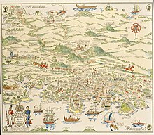
Auckland isthmus
[4] The isthmus in its current structure was formed at the end of the Last Glacial Maximum (known locally as the Ōtira Glaciation), between 12,000 and 7,000 years ago.
[5] As sea levels rose, the river valley to the north, which was carved through the Miocene marine sediments of the Waitemata Group, drowned and became a tidal estuary, the Waitematā Harbour.
[6] During the Last Glacial Maximum, the modern isthmus was dominated by podocarp-angiosperm forest such as kahikatea, Prumnopitys taxifolia (matai) and tree ferns such as Alsophila smithii (kātote).
Underneath much of the isthmus are lava caves formed from eruptions such as Maungawhau / Mount Eden (circa 28,000 years ago).
[13] The eruption of Maungarei / Mount Wellington (circa 10,000 years ago)[11] blocked existing creeks on the isthmus and led to the formation of Waiatarua, a former lake and current wetland reserve/golf-course in Remuera/Meadowbank.
[14][7] Low-lying swamps were predominantly vegetated with Cordyline australis (cabbage tree / tī kōuka) and Phormium tenax (harakeke flax),[10] and also formed behind beach deposits at the mouths of streams[15] The volcanic eruptions led to the creation of the Epsom rock forest / Almorah rock forest, an ecosystem unique to the isthmus formed of trees such as Meryta sinclairii (puka), Litsea calicaris (mangeao), Alectryon excelsus (tītoki), Melicytus ramiflorus (māhoe), Piper excelsum (kawakawa) and Pseudopanax lessonii (houpara) growing in a primarily in a rock and leaf humus environment, with minimal soil.
[2][21] The Auckland isthmus was an early location visited by many of the Māori migration canoes, including the Matahourua, Aotea, Mātaatua, Tainui, Tākitimu, Tokomaru, Te Wakatūwhenua and Moekākara waka.
Land underwent periods of shifting cultivation, where once the soil was exhausted, a new field would be tilled, and the former would be colonised by fast-growing native plants.
[29][30][31] After harvesting, crops would be stored in rua kūmara, a storehouse fitted over a dry pit that is often found on the volcanic cones of the isthmus.
[2] The Te Taoū hapū of Ngāti Whātua defeated Kiwi Tāmaki, the paramount chief of Waiohua circa 1741, at a battle at Paruroa (Big Muddy Creek) in the lower Waitākere Ranges.
[38] By the time missionaries Samuel Marsden and John Gare Butler visited the isthmus in 1820, there were thousands of inhabitants living along the shores of the Tāmaki River.
[40][30][39] Ngāti Pāoa began to return to the Hauraki Gulf region in the 1820s, however primarily focused resettling Waiheke Island, where there were many trade opportunities with whalers.
[7] The shoreline of the Waitematā Harbour was populated with pōhutukawa trees, however during the 1840s onwards most mature specimens were cut down to use for ship building.
[41] In 1840 after the signing of the Treaty of Waitangi, paramount chief Apihai Te Kawau made a tuku (strategic gift) of land at Waihorotiu on the Waitematā Harbour to William Hobson, the first Governor of New Zealand, as a location for the capital of the colony to develop.
[36] Land at Mechanics Bay was eventually established as a general area for Ngāti Pāoa, other iwi and poorer visitors to Auckland, which was declared a public domain in 1898.
[39] Between 1847 and 1852, the towns of Onehunga, Ōtāhuhu and Panmure were established by Governor George Grey as outposts for the Royal New Zealand Fencible Corps, a collection of retired British and Irish soldiers, to serve as a buffer against a perceived threat of war from the south.
[44] Onehunga on the Manukau Harbour became a major port town, facilitating trade with Manukau-based Tāmaki Māori and Waikato tribes, who would sell and barter resources such as peaches, melons, fish and potatoes.
[16] By the late 1860s, the economy on the isthmus began to decline, after soldiers left the area at the end of the invasion, and because the capital was moved south to Wellington.
[62] The first of these, dubbed the "Ōrākei Garden Suburb", was envisioned as an area primarily for lower class families while providing high quality housing impossible in the inner city slums.
[49] The land the Ōrākei public housing estate was constructed on was Ngāti Whātua Ōrākei land, which between 1886 and 1950 was either sold by individuals to the Crown or taken through the Public Works Act, including Bastion Point (taken for a defensive fort in 1886) and the Ōkahu Bay sewage plant in 1908 (now the site of Kelly Tarlton's Sea Life Aquarium), which caused significant pollution in the bay near the Ngāti Whātua kāinga.
[46][42][65] The kāinga and marae at Ōkahu Bay were seized and burned in 1952, under the pretense of beautification for the royal visit of Queen Elizabeth II in 1953, and the residents were relocated to nearby state housing.
The first section that opened was the Northwestern Motorway in 1952, connecting Westerview to the Te Atatū Peninsula in West Auckland, to create a dedicated corridor to reach the civilian airport at Whenuapai.
Council-funded multi-storey flats had begun to be built in the central suburbs by 1954, however the wide-scale plans for demolition of older housing stock never went ahead.
[49] The 1987 stock market crash led to the collapse of many property development companies, and much of the office space they had built was repurposed as residential apartments.
[60] This was seen again in 2011, when the Rugby World Cup led to the redevelopment of Wynyard Quarter, Queens Wharf, Eden Park and the central Auckland train stations.
[60] Language schools and private training establishments specialising in subjects such as tourism and hospitality became common in central Auckland.
[135] Attempts to create local government on the isthmus began in 1851, hampered by extensive costs for roads and the 1860s economic downturn, however by April 1871 the Auckland City Council had been established around the modern-day CBD.
[62] In 1882, neighbouring road boards of Ponsonby, Karangahape and Grafton amalgamated with the city due to the improved services and infrastructure offered by the council.
[62] From 1904, a stronger focus on amalgamating surrounding areas called the Greater Auckland scheme was undertaken, inspired by similar movements in Wellington and Christchurch.
[136] This led to amalgamations with Arch Hill (1913), Grey Lynn (1914), Parnell, Remuera and Eden Terrace in 1915, followed by Epsom (1917), Point Chevalier (1921), Avondale (1927) (a merger which increased the Auckland City area by 40%), and eventually Ōrākei and rural Tāmaki to the east of the isthmus in 1928.