Wetar Strait
[1][3] Wetar Strait is enclosed by the Banda Sea, the southern limit of which runs from the eastern extremity of Timor along its north coast as far as longitude 125° East.
The archipelago is the only interocean connection on earth at low latitudes, and the exchange of water between the two oceans is known as the Indonesian Throughflow (ITF).
[8]: 18 The shallow coastal waters along the northern littoral of Timor-Leste are dominated by a seagrass bed about 2,200 ha (5,400 acres) in total area.
However, the country's mangrove cover has very substantially declined since 1940, and in the Wetar Strait is now confined to the coastline and hinterland between Cape Fatucama and Manatuto.
Uniquely, the landward zone of both areas is dominated by stunted dense Ceriops tagal or Avicennia, or a mix of the two.
[11]: 2-29–2-30 The far north western end of the strait includes an Important Bird Area (IBA), Atauro Island.
The designation recognises the importance of conserving the open waters on the north side of Timor-Leste, with their globally-significant coral reefs and marine biodiversity.
[24] The Berlin-Ramelau [de] operates internal East Timorese ferry services linking Dili with Manatuto, Baucau, Lautém and Viqueque via the Wetar Strait.
[4] Timor-Leste has refused advances by China seeking off-shore oil rights and permission to set up radar arrays ostensibly to counter illegal fishing.
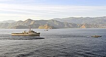
[4][24] By the mid-1970s, the Ombai-Wetar route had been identified as one of five international straits essential for passage by U.S. ballistic missile submarines, the others being Gibraltar, Malacca-Singapore, Lombok and Sunda.
Many of the fishers fish part time or seasonally, and are otherwise occupied in additional activities such as carpentry, labouring or security work.
Most of the fish landings are of small pelagic species, including short-bodied mackerel, sardines (Clupeidae), halfbeaks and scads (Carangidae).
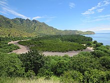
The coastal mountains around Subaun, on the strait between Dili and Manatuto, include cliffs and hillsides with excellent panoramic views.
Networks of local residents record cetacean movements and behaviour, and then report it in 'real time' to researchers and Dili-based whale watching tour operators.