Wiese (river)
After crossing the international border, the lower reaches of the river pass through the canton of Basel-Stadt, mainly through the city of Basel and through its district of Kleinbasel before emptying into the Upper Rhine.
Leaving from the Feldberg, it flows, hemmed in by the steep mountainsides of the High Black Forest, past the hamlets of Fahl and Brandenberg, still as a mountain stream, and through the village of Todtnau.
After leaving Riehen, in the district of Kleinbasel, the river crosses under the Karlsruhe–Basel high-speed railway and, shortly thereafter, at the junction of the Swiss A2 and A3, under the A2, which becomes the German A5 motorway a little further to the north.
The Wiese finally enters the Upper Rhine between the Kleinbasel quarters of Klybeck to the south and Kleinhüningen to the north at a height of 244 m above sea level (NN).
The biggest tributary of the Wiese is the Kleine Wiese, which gives its name to the collective municipality of Kleines Wiesental, and which is fed by two headstreams, the Belchenwiese (source on the southern slopes of the Belchen) and the Köhlgartenwiese (rises southwest of the Belchen on the southern slopes of the Köhlgarten), which merge in Tegernau.
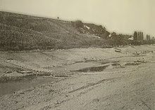
In the upper reaches, near Todtnau and Gschwend, the Wiese flows in some places through gorge-like valleys with rapids and small waterfalls.
As a result of the melting of ice age glaciers, large quantities of meltwater were released and the Wiese cut downwards up to 15 metres below today's level.
As a result of the river's low storage capacity in the catchment area in the upper reaches of the Wiese and the combination of sudden snow melts during the föhn and heavy rainfall, flooding used to occur regularly in the past causing great damage to the population, property and the countryside.
The increasingly severe floods of the second half of the 19th century were put down by contemporary writers to the ruthless deforestation of woods in the Kleine and Grosse Wiese valleys and the desolate and worthless areas on the Feldberg and Belchen, which were clearly unable to retain the amount of water that they had been able to in the past.
On the lower terraces of the last ice age, where they settled, the medieval villages were largely spared from floods caused by the Wiese which, at that time could still spread unimpeded across its river meadows.
However, with increasing cultivation of the fertile floodplains, the need grew for farmers and landowners to protect valuable land from flooding by the Wiese and to strengthen its banks.
The first large-scale corrections were carried out between Hausen and Stetten between 1806 and 1823, because agriculture, traders and the newly established industrial enterprises in the Baden part of the Lower Wiesental suffered the consequences of the floods far more than the Swiss riverside landowners in Riehen and Basel.
The canalisation of the river between Lörrach and Hausen was designed and carried out by Baden water engineer, Johann Gottfried Tulla.
The Schindler system proved unsatisfactory in the early years so that, between 1905 and 1910, the original wooden defences had to be replaced by stone blockwork.
However, thanks to the Schindler's profile, a remarkable river meadow was formed between the state border and the Riehen swimming pool developed over the course of time on the right bank of the Wiese.
The seasonal floods that occurred and the large amount of debris were always detrimental to the riverbank defences and height of the riverbed and thus on the capacity of the river bed.
The corrective measures carried out in the Baden part of the Wiese resulted in an increased discharge of the floodwater into the Swiss area and thus imposed a greater load on the local flood defences.
Only after the formation of the so-called state association in Baden and the takeover of the river route in the Riehener Bann by the canton of Basel could long-term defences on the Wiese be ensured.
In the Early Middle Ages the fishing grounds were still accessible to everyone, but no later than the implementation of royal rights by the Frankish kings, was the fishery (Fischweid) established, whereupon the general use of the river by the population was forbidden.
Fishermen had to take account of the closed season, minimum sizes, boundaries and water use rights of the mills and timber rafting industry.
High levels of water pollution, the canalisation of the Wiese and the construction of un-bypassable power stations on the Rhine destroyed the habitat and the migration routes of many aquatic animals and thus the economic basis of fishing.
In addition, they contribute significantly to the maintenance of the Wiese and other watercourses in the Wiesental as part of joint river cleaning activities.
The aqueducts on the territories of Lörrach, Stetten and Riehen ran in the former streambeds of the side branches of the Wiese in which small streams on the edge of the tread of the lowest terrace (Hochgestade).
There were further conflicts of use after the Basle-based manufacturer, Major Geigy-Lichtenhahn, established a mechanical spinning and weaving mill on the outskirts of the village in 1834.
Today, the Mill Route and the line of the old channel west of the Steinen hydroelectric power station witness to the old aqueduct.
It was once again the city of Basel which developed the timber resources of the Black Forest as a result of the economic boom in the printing and paper industry.
For timber rafting, a 6-foot-wide canal was built, down which more than 7,000 klafters of wood (equivalent to about 14,700 cubic metres) was transported to Basel every year.