Wilkie Sugar Loaf trail
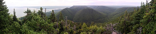
[1] The trail leads to the 411.8 metres (1,351 ft) summit of Wilkie Sugar Loaf in the Cape Breton Highlands.
The trail is approximately 3.2 kilometres (2 mi) (return) in length and is mostly a steady upward climb, rising over 350 metres (1,150 ft) to the peak of Wilkie Sugar Loaf Mountain.
In the late 1960s there was a 6 m (20 ft) tall wooden tower on the summit, located over the survey station.
10 teams of 4 hikers climbed Franey, Wilkie Sugar Loaf and Acadien mountains in one day.
The Wilkie Sugar Loaf trail was cleared and re-flagged in early July 2014 in preparation for this event.