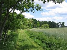
Woodland edge
[citation needed] On topographic maps woods and forests are generally depicted in a soft green colour.
In addition, working out the exact edge of the wood or forest may be difficult where it transitions into scrub or bushes or the trees thin out slowly.
For specialised work, aerial photographs or satellite imagery are frequently utilised without having to revise the maps.
Cadastral maps cannot show the current situation because for reasons of cost they can only be updated at fairly long intervals and cultural boundaries are not legally binding.
At the woodland edge trees are often different from those inside the wood, as well as hedge vegetation, brambles and low-growing plants.