World Geographic Reference System
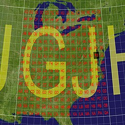
The World Geographic Reference System (GEOREF) is a geocode, a grid-based method of specifying locations on the surface of the Earth.
GEOREF is essentially based on the geographic system of latitude and longitude, but using a simpler and more flexible notation.
GEOREF was used primarily in aeronautical charts for air navigation,[1] particularly in military or inter-service applications, but it is rarely seen today.
GEOREF co-ordinates are defined by successive divisions of the Earth's surface, as follows: The initial two letters of a GEOREF reference, designating the 15 degree quadrangle, can be omitted, if it is clear which 15 degree quadrangle the reference applies to (e.g., when working within a restricted geographical area).
For example, on a GEOREF chart, Naval Air Station Patuxent River (38°17′10″N 76°24′42″W) / (38.286108, -76.4291704) is located (to the nearest minute) at position GJPJ3417.