Yorkshire Wolds
A fault which downthrows the rock strata to the west effectively truncates the Wolds at Hunmanby in the northeast, though the offset chalk outcrop continues east to the coast at Speeton Cliffs.
[5][6] The numerous dry valleys cut into the dip-slope are typically floored by head, locally derived clay, silt, sand and gravel.
[7] Most of the area takes the form of an elevated, gently rolling plateau, cut by numerous deep, steep-sided, flat-bottomed valleys of glacial origin.
The chalk formation of the hills provides exceptionally good drainage, with the result that most of these valleys are dry; indeed, surface water is quite scarce throughout the Wolds.
The unusual topography results in an "upside-down" farming system – livestock (mostly sheep and cows) graze the valleys, with the hills above used for crops.
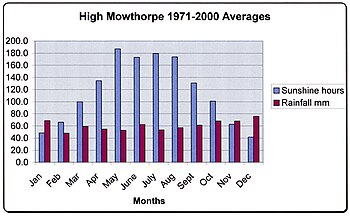
Located in the northern part of England, UK, the Yorkshire Wolds have a temperate maritime climate which is dominated by the passage of mid latitude depressions.
The higher ground of the Wolds results in their being slightly cooler than the surrounding lowland areas and drifting snow is a problem in winter.
[10] To the south of Flamborough lies the resort town of Bridlington and to the north the sheer cliffs at Speeton overlook Filey Bay.
A series of villages lies at the foot of the northern scarp of the Wolds each having a parish which contains an area of chalk hillside, fertile benches and marshy land on the Vale of Pickering.
Close to Ruston Parva is Danes Graves, an archaeological site consisting of some 500 small round barrows marking Iron Age burials at least one of which yielded a corpse buried with a chariot and harness.
[13] North Newbald is sited in a narrow valley on the western scarp of the Wolds and has a famous cruciform Norman church dedicated to St Nicholas.
[11] Beverley sits in the north-eastern corner of the Southern Wolds, with the common grazing lands of Swinemoor and the Figham Pastures being where the hills terminate, where extensive wetlands exist.
[18] From Garrowby Hill northwards to Ganton the high scarp of the Wolds swings in a crescent to overlook the Vales of York and Pickering.
[21] The availability of fertile chalk soils, good grazing and the light tree cover along with stone suitable for making tools made this area attractive to early Neolithic settlers.
[21] Along with Wessex and Orkney, the Yorkshire Wolds is a key area for studying the development of the Neolithic period in the British Isles as it became a major focus for settlement in this era.
Isolated farms rather than settlements of any size appear to have been the normal dwelling types however few have been located with any certainty and most evidence is of funerary sites and ritual monuments.
A well-known round barrow of this period is the monumental Duggleby Howe, at the western end of the Great Wolds Valley, partially excavated in 1890 by J.R. Mortimer.
An extensive Neolithic ritual complex, the main elements of which are four large cursus monuments and a henge, is situated near the eastern end of the Great Wold Valley.
More than 1,400 Bronze Age round barrows, comprising one or more burials and accompanied by items of grave goods, are known to exist on the Yorkshire Wolds.
Many of these sites, although they have been reduced in size by repeated ploughing, still form upstanding and, in some cases, prominent features in the present-day landscape.
[23] From a base at Brough on the north bank of the Humber they established a road network with one branch towards York and another to Malton, both crossing the Wolds area.
[24] In 2014, two horse skeletons and the remains of a chariot dating back to the Iron Age were unearthed on a Pocklington building site.
David Hockney has featured the Yorkshire Wolds in many of his paintings that were shown at the Royal Academy in the exhibition 'A Bigger Picture' in the spring of 2012.