Klondike Highway
The original 53 km (33 mi) section known locally as the Carcross Road was actually made into a part of the Alaska Highway in 1942, until the Marsh Lake route was opened the next year.
Residents living as far south as 25 km (16 miles) from the Alaska Highway still give their residential addresses as historic mile measurements that start at zero at the Alaska Highway, even though the distances are no longer accurate, and kilometre posts count distance from Skagway's ferry terminal.
The Carcross-Skagway Road portion of the highway underwent substantial rerouting, widening and (cold mix) paving in the late 1980s and early 1990s.
Mining ore trucks and fuel tankers are the primary current (2013) commercial users of the highway, which also remains a popular tourist route (cars, RVs, buses), and provides a means for the WP&YR to offer economically-priced train excursions connecting at Fraser to buses based at Skagway for the cruise ship industry, or to/from Carcross and Whitehorse to the north.
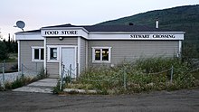
The "Whitehorse-Mayo Road," Yukon's original Highway 2, extended along today's route from Whitehorse to Stewart Crossing, then turned northeast to Mayo, Elsa and Keno City.
Although kilometric distance markers have been in place since the early 1980s, residents in this area still identify their residential address as a mile measurement along the Mayo Road.