1974 Super Outbreak
While moving into the Mississippi and Ohio Valley areas, a surge of unusually moist air intensified the storm further, while there were sharp temperature contrasts between both sides of the system.
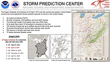
[9] On Wednesday, April 3, severe weather watches already were issued from the morning from south of the Great Lakes, while in portions of the Upper Midwest, snow was reported, with heavy rain falling across central Michigan and much of Ontario.
The mid-latitude low-pressure center over Kansas continued to deepen to 980 mb (28.94 inHg), and wind speeds at the 850-mb level increased to 50 kn (58 mph) (25.7 m/s (93 km/h)) over portions of Louisiana, Mississippi, and Alabama.
Due to significant moisture advection, destabilization rapidly proceeded apace; the warm front near the Gulf Coast dissipated and then redeveloped northward over the Ohio River valley.
[10] Meanwhile, a large mesoscale convective system (MCS) that had developed overnight in Arkansas continued to strengthen due to strong environmental lapse rates.
The split was related to several factors, including a band of subsidence over eastern Kentucky and western West Virginia; local downslope winds over the Appalachians; and an inversion over the same area.
[11] Several of the storms to form between 19:20 and 20:20 UTC became significant, long-lived supercells, producing many strong or violent tornadoes,[9] including three F5s at Depauw; Xenia, Ohio; and Brandenburg, Kentucky.
[11] While violent tornado activity increased over the warm sector, a third band of convection developed at about 16:00 UTC and extended from near St. Louis into west-central Illinois.
Based upon real-time satellite imagery and model data, differential positive vorticity advection coincided with the left exit region of an upper-level jet streak which reached wind speeds of up to 130 kn (150 mph) (66.9 m/s (241 km/h)), thereby enhancing thunderstorm growth.
[11] These storms, forming after 23:00 UTC, produced some of the most powerful tornadoes of the outbreak, including a large and long-tracked F4 that struck the western and central portions of Alabama, tracking for just over 110 miles (180 km), two F5s that both slammed into Tanner, causing extensive fatalities, an extremely potent F5 that devastated Guin in Alabama, and multiple violent, deadly tornadoes that affected and caused fatalities in Tennessee.
It is probably the least-known of the F5 tornadoes in the outbreak as it traveled through rural areas in southern Indiana northwest of Louisville, traversing about 65 miles (105 km) through parts of Perry and Harrison Counties.
The massive tornado slammed into the western part of Xenia, completely flattening the Windsor Park and Arrowhead subdivisions at F5 intensity, and sweeping away entire rows of brick homes with little debris left behind in some areas.
[9][23] Several railroad cars were lifted and blown over as the tornado passed over a moving Penn Central freight train in the center of town.
[24] It toppled headstones in Cherry Grove Cemetery, then moved through the length of the downtown business district, passing west of the courthouse (which sustained some exterior damage).
Numerous businesses in downtown Xenia were heavily damaged or destroyed, and several people were killed at the A&W Root Beer stand as the building was flattened.
In addition to the direct fatalities, two Ohio Air National Guardsmen deployed for disaster assistance were killed on April 17 when a fire swept through their temporary barracks in a furniture store.
One of the few consolations from the tornado was that a century-old bronze bell that belonged to the White County Courthouse and served as timekeeper was found intact despite being thrown a great distance.
The tornado quickly became violent as it moved into Meade County, producing F4 damage as it passed north of Irvington, sweeping away numerous homes in this rural area.
[35] A news photographer reported that the tornado "left no grass" as it crossed KY 79 in this area, and canceled checks from near Irvington were later found in Ohio.
[36] Trees and shrubbery in town were debarked and stripped, extensive wind-rowing of debris occurred, and numerous vehicles were destroyed as well, some of which had nothing left but the frame and tires.
Most of the small town of Tanner, located to the west of Huntsville and south of the Limestone County seat of Athens, was destroyed when two F5 tornadoes struck the community 30 minutes apart.
[48] The storm then slammed into Tanner, where many homes were swept away, vehicles were tossed, shrubbery was debarked, and Lawson's Trailer Park sustained major damage.
[9] Numerous homes in Harvest and surrounding rural areas of the county were swept completely away and scattered, and extensive wind-rowing of debris was noted.
[9] It formed at around 8:50 pm CDT near the Mississippi-Alabama border, north of the town of Vernon, striking the Monterey Trailer Park, resulting in major damage at that location.
[9][56] Past Delmar, the tornado grew up to a mile wide as it tore through the William B. Bankhead National Forest, flattening a huge swath of trees.
Surveyors noted that timber damage was equally severe at all elevations in this area, with numerous trees snapped both along exposed ridges and in deep gorges.
[69] In Alderson, West Virginia, "tornado-like winds" caused extensive damage to homes and businesses primarily along WV 3, some of which had their roof torn off.
[70] On April 5, Georgia Governor Jimmy Carter declared 13 counties as disaster areas and put in a request to President Nixon for federal aid, citing damage in excess of $15.5 million.
[72] The Federal Disaster Assistance Administration (later FEMA) indicated that trailers refurbished after the 1972 Buffalo Creek flood would be used to house displaced persons.
[75] On April 10, voting on the Disaster Relief Act of 1974 was expedited and passed unanimously in the United States Senate in direct response to the scale of damage from the tornado outbreak.


generated in United States during the 1974 Super Outbreak. One tornado was deconfirmed and determined to be a microburst.