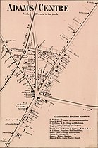
Adams Center, New York
The exact date of the name change is not known, but the hamlet became known as "Adams Centre", a spelling that continued until approximately 1900.
US-11 and I-81 each lead north 10 miles (16 km) to Watertown, the Jefferson county seat.
NY-177 leads east across the Tug Hill Plateau 24 miles (39 km) to West Lowville.
As of the 2000 United States Census,[8] there were 1,500 people, 560 households, and 398 families residing in the village.
There were 617 housing units at an average density of 124.5 per square mile (48.1/km2).
22.1% of all households were made up of individuals, and 8.8% had someone living alone who was 65 years of age or older.