Ager Vaticanus
[1] After the Roman conquest of the rival city in 396 BC, the Centuriate Assembly kept the tradition of raising an ensign on the summit of the Janiculum hill, to signal a possible Etruscan raid.
After Cincinnatus paid a large punitive fine for his son, it was recorded that he retired "like an exiled man" to his property in the Ager Vaticanus, although the plain was already Roman territory.
[1] The Ager Vaticanus lowland was exposed to the periodic floods of the Tiber, hosted vegetable gardens and vineyards, and was known for its unhealthy climate and bad wine[1][7] until the end of the first century BC, when the development of local roads along the Via Cornelia (towards the port of Caere), the via Triumphalis towards Veii and the via Aurelia nova[8] made possible for the families of the aristocracy the construction of luxurious private suburban residences (Horti).
[7] According to Roman tradition, therefore, necropolises and sepulchers also settled along the streets that crossed it,[16] and were normally left in place until the need arose to demolish them to make room for new buildings (like the Basilica of Saint Peter),[17] or to recover materials.
[18] This was the fate of the so-called Meta Romuli (the other funerary pyramid existing in Rome in addition to that of Gaius Cestius outside Porta San Paolo) [19] and the nearby large cylindrical monument with overlapping tower called Terebinthus Neronis; both burials were often considered in the Middle Ages as the place of Peter's martyrdom.
[21] The most recent discovery in this field (which occurred in 2003 but was published only in 2006) is that of the large necropolis known as Santa Rosa's,[16] along the via Triumphalis, which came to light during the excavation of the Vatican car park under the Janiculum hill.
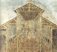
[24] Thus began the construction, in the 4th century, of the first basilica dedicated to St. Peter, established according to Christian usage above what tradition claims is his tomb (the confessio), and founded on the north side of the Gaianum along the Via Cornelia.