Airedale
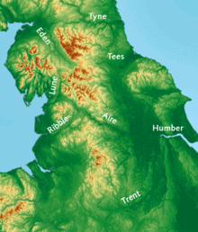
Airedale, in conjunction with the Ribble Valley, provides low-altitude passes from Yorkshire to Lancashire through the Aire Gap.
The peoples that occupied the Aire Valley (and much of north eastern England) were called Brigantes by the Romans.
[4] Transport improved in the 18th and 19th centuries with the building of the Aire and Calder Navigation[5] and the Leeds and Liverpool Canal.
From Aire Springs the river flows past Skipton and Keighley, through Bingley, Saltaire, Shipley and into Leeds.
The Aire Catchment Flood Management Plan (CFMP), which takes into account all the becks and streams that feed the river, lists the Worth Valley and most of Bradford City as part of Airedale.
[8] Similarly, the Airedale Partnership's Masterplan, which is sponsored by Bradford Council, shows the same boundaries as the Aire CFMP.
The heavy industry east of Leeds is still in existence and two of the three coal fired powers stations in the lower section take their water from the River Aire.