Alberta Highway 3
Together with British Columbia Highway 3 which begins in Hope, it forms an interprovincial route that serves as an alternate to the Trans-Canada from the Lower Mainland to the Canadian Prairies.
3, it was designated as a southern branch of the former Trans-Canada Highway by the 1920s and improved to gravel then eventually paved, widened with shoulders, and upgraded to an expressway in sections.
Alberta Transportation has long-term plans to upgrade the entire route to a freeway; the work will include twinning west of Fort Macleod and east of Taber, and an eventual elimination of at-grade intersections.
The Fort Macleod–Lethbridge segment also comprises the westernmost portion of the Red Coat Trail, a historic route advertised as that which was travelled by the North-West Mounted Police in the late 19th century in their quest to bring order and peace to the region.
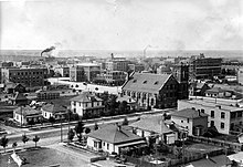
[11] Immediately east of Highway 25 it descends into the Oldman River valley, entering city limits near a trumpet interchange at Bridge Drive.
Crowsnest Trail continues east as an expressway past several at-grade intersections to 43 Street, a busy thoroughfare on the eastern city limit of Lethbridge and the northern end of Highway 4.
[12] The inception of the trail that would become Highway 3 was similar, with the 1898 completion of a main line of the Canadian Pacific Railway spurring development in the Crowsnest Pass region.
[13] The railway connected Kootenay Landing near Creston, British Columbia to Lethbridge and was the primary method of transport until a rapid increase of private automobile use in the early 20th century.
[12][13] In 1926, major highways in Alberta began receiving numbers; previously all routes had been identified by coloured bands tied to telephone poles.
Highway 3 has existed in Alberta on generally the same alignment since the 1910s, with only relatively minor changes made to a rough road called the Red Trail that had been carved from Medicine Hat to Crowsnest Pass.
[18]: 90 Work immediately began to clear the railway of debris, but a new trail north of the slide was created, connecting Frank and Bellevue.
[1] Officials had aimed for the ceremony to be held in September, but final work on the road had been delayed by the Canadian Pacific Railway who were unhappy with the location at which the highway crossed the railroad, causing the originally surveyed route to be altered.
[27] The group included local officials, farmers and residents who argued that the Red Trail connected key population centres and irrigation districts in southern Alberta, and was a component of an interprovincial route from Vancouver to Winnipeg.
[28] At this time, British Columbia had done work to their portion of the highway allowing it to remain open year-round so it was desirable for Alberta to follow suit.
[28] The general sentiment among southern Alberta officials was that the Red Trail was a shorter and preferable route compared to the northern branch of the Trans-Canada through Calgary.
[28] Minister of Public Works Oran McPherson in 1934 announced that the section between Bow Island and Medicine Hat would be gravelled, permitting all-weather travel for the entire length of Highway 3.
Citing safety and efficiency for motorists, Taylor stated that the province would prefer for major highways to not travel through towns, but extra mileage would not be created to accomplish this.
[37] Nevertheless, the Chamber was still concerned about the condition of the road, particularly in the Crowsnest Pass region where mountainous terrain and steep grades were making upgrades difficult.
[39]: 61 The existing two-lane bridge over the Oldman River that had been constructed in 1946 was widened to four lanes, and a partial interchange at 5 Avenue N built by 1968 completed the realignment.
[40] The interchange had been constructed by summer 1976,[39]: 12 delayed several weeks by unstable terrain necessitating steel beams to supplement the concrete piles for the bridge.
[43] Several local Social Credit Party Members of the Legislative Assembly (MLA) expressed dissatisfaction with the rate at which the work was progressing and the reasoning given by Highways Minister Clarence Copithorne.
[4] Long-term planning for a Highway 3 expressway was on-going near the end of the decade, with minor changes to the two-lane route near the BC border in the late 1970s.
[53] It involved the construction of a new four-lane expressway from 43 Street to the existing Highway 3 on the east bank of the Oldman River between North and West Lethbridge, and new interchanges at 5 Avenue N and Scenic Drive.
Transport Minister Henry Kroeger disagreed and thought the concerns were unwarranted; of Fort Macleod, he stated, "the town won't disappear as a result of the interchange.
At the east end of Blairmore, a new bridge over the Crowsnest River was constructed,[39]: 59 and the highway curves north around the community before rejoining the existing alignment west of the town.
Alberta Transportation minister Steve West announced in 1995 that Barnwell would not be bypassed, and the twinned highway would instead continue on its existing alignment through the centre of the village at a reduced speed limit.
[69] Some members of the community opposed the decision, citing increased vehicular safety of the recommended bypass alignment south of the village, and a safer environment for pedestrians who would not have to cross highway traffic.
[68][71] In 1999, Infrastructure minister Ed Stelmach stated that twinning the remainder of the highway from Taber to Medicine Hat was not a priority, despite pleas from local officials.
[72] Alberta Transportation has long-term plans to upgrade the entire length of Highway 3 to a freeway, requiring major bypasses of Fort Macleod and Lethbridge.
[75]: 11 A freeway upgrade of Crowsnest Trail was considered, but would require extensive reconstruction and demolition within the corridor through Lethbridge, and twinning of the existing bridge across the Oldman River.