Alor Island
Alor Island, as well as the rest of its archipelago, is part of East Nusa Tenggara province.
The main part of the island is mountainous, but there is a prominent peninsula along its north coast which includes the main town of Kalabahi; the peninsula encompasses the administrative districts of Alor Barat Laut and Kabola, plus the northern half of the Mutiara Bay District (kecamatan Teluk Mutiara).
The shock had a moment magnitude of 7.5 and a maximum Mercalli intensity of VIII (Severe).
(e) including the town of Kalabahi, and neighbouring rural desa on both sides of Mutiara Bay, plus uninhabited Pulau Kapas.
The latest geological explorations have discovered valuable resources such as gypsum, kaolin, petroleum, natural gas, tin, gold, and diamonds.
Alor hosts some of the most healthy and diverse corals in Indonesia and has areas of black volcanic sand for specialized scuba diving interests.
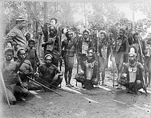
These include Abui, Adang, Hamap, Kabola, Kafoa, Woisika, Kelon, and Kui.
Many of the Papuan languages of Alor are endangered and are no longer being actively acquired by children.
Significant linguistic documentation efforts have been undertaken recently by Leiden University.
Flights originating in Bali, Surabaya or Jakarta with the final destination of Alor stop in Kupang to change planes.