Altinum
Altinum (in Altino, a frazione of Quarto d'Altino) was an ancient town of the Veneti[1] 15 km southeast of modern Treviso, close to the mainland shore of the Lagoon of Venice.
This led to a gradual ethnic mixing and loss of cultural identity, especially in the border areas of the Veneti: Verona in the west and the Lagoon of Venice and the Piave valley in the east.
In some places there was at times a transition from the traditional practice of cremation to inhumation and the deposition of weapons in burials, which was an exception to Veneti funerary culture.
The transformation of Altinum from a Veneti to a Roman town started with the reorganisation of its marshy environment through the regulation of its waters and the expansion of its canal network.
The foundation of the colony of Aquileia, in Celtic territory, as a fortress to protect northern Italy from invasions from the northeast and east was an important moment in the process of Romanisation of the Veneti and Altinum, which is traceable to the first half of the 2nd century BCE.
Inscriptions attest to an early presence of the Publicia, Barbia, Cossutia and Saufeia families in Aquileia and Virunum (modern Magdalensberg), a town in Noricum (in present-day Austria) where there was iron mining.
Pollio Asinius was either the last governor of the Venetia region of Roman Italy or a member of a commission charged with distributing land to war veterans.
He also extended the navigable route inside the Septem Maria lagoons,[14] to Altinum with the construction of a further canal, the fossa Clodia, thus connecting it to Ravenna.
The Codex Theodosianus (Theodosian Code), a compilation of Roman laws under the Christian emperors from 312 to the 430s, was commissioned by Theodosius II and Valentinian III in 429 and published in 438.
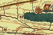
[27] According to the Chronicon Venetum et Gradense, the earliest Venetian chronicle, written by John the Deacon in the mid-10th and early 11th-century, refugees from Altinum fled to Torcello and other islands in the northern part of the Lagoon of Venice.
Agriculture played a secondary but fundamental role in favouring new stable settlements through intensive cultivation of limited land areas, which were probably uncultivated.
"[28] After the fall of the western part of the Roman Empire (conventional date 476 BCE), the Ostrogoths invaded Italy and established the Gothic Kingdom (493–553).
[26] Marcus Valerius Martialis (Martial), the 1st-century poet, wrote: "You banks of Altinum, that rival the rural beauties of Baiae, ... and you, Aquileia ... You shall be the haven and the resting-places of my old age, if my retirement be at my own disposal.
Strabo, the 1st-century BCE geographer, gave a description of northern Italy and the Veneto: "The whole of this country is full of rivers and marshes, especially the district of the Veneti, which likewise experiences the tides of the sea.
"[34] In his description of the Veneto Region, Pliny the Elder, the 1st-century BCE and CE naturalist, wrote that the River Sile flows from the hills of Treviso to Altinum.
Regarding the Pectine nigerrimi cockles, Pliny the Elder wrote, "the pectine, the biggest ones and among them those more black in the summer are the most they are found at Mytilene, Tindari, Salona, Altinum ..."[40] In his treatise on agriculture (De Re Rustica), Lucius Junius Moderatus Columella (4–70 CE) wrote, "For this use it is better to procure cows from Altinum, which the people of the area call "Ceve".
BCE) mentioned "... the sheep of Mileto, Selegas, Altinum, or those for which Tarentum or Baetica are renowned, because the nature of those places gives colour to the wool.
The monks of the monastery of Santo Stefano moved to the Tumba Leseda island (nowadays it is called La Salina) in the archipelago of the settlement of Ammiana in 900.
The wetland environment, which was rich in vegetation due to watercourses fed by melting ices and springs in the plain, made up for the survival difficulties created by the hot and arid climate of the late boreal age.
[2] An early Neolithic site of farmers and grazers with artefacts typical of the cultures of central-northern Italy of this time has been found in the nearby Tessera.
The quarry was later filled in by a settlement centred around a large building (13 m long and 6.75 m wide) with two internal asymmetric spans which must have supported a double-pitched roof.
[4][3] In the 5th century BCE, this sanctuary was a large outdoor space enclosed by a rectangular portico which had two symmetric cells at the centre of its short sides.
Their dating is problematic as the road was progressively widened until it reached a width of 12 m. In the area of the Via Claudia Augusta, to the north-west of the town, there were traces of ditches and small canals attributable to a late antiquity systematic parcelling out of land and maintenance interventions.
In the early 1990s an investigation of the layer below a town gate on a canal pushed back its dating, which was previously attributed to the Augustan period, to the first half of the 1st century BCE and brought to light the remains of an imposing foundation ceremony.
Several sumptuous examples were found in the monumental cemetery by the Via Annia, where the ruling elite started to build their grandiose burials in the last decades of the 1st century BCE.
[4] In 2007 a team of geomorphologists from the University of Padua carried out a survey with visible and near-infrared (NIR) aerial photographs which were taken after a period of prolonged drought and developed a digital elevation model (DEM) to reconstruct the urban topography and the environmental setting of Altinum.
This tallies with some 1972 samplings on the eastern bank of the secondary canal which found the foundations of a brick quay resting on wooden piling and seven rectangular plinths related to a big building which is identified as a warehouse.
[54] In 1972 the foundation of a 16.3 m brick dock with fully curved arches linked to a large building was found close to the gate, on the eastern bank of a secondary canal which branched off the main one inside the urban area.
It was in a key position in the immediate vicinity of the southern entrance of the town and along a fluvial route which started from the port and must have gone through the Santa Maria canal.
From here, goods could reach the inland markets overland via the Via Annia or by following a wide canal with wooden banks which flanked this road in the north.