Celestial navigation
The Moon, a planet, Polaris, or one of the 57 other navigational stars whose coordinates are tabulated in any of the published nautical or air almanacs can also accomplish this same goal.
The latitude and longitude of that point are known as the celestial body's geographic position (GP), the location of which can be determined from tables in the nautical or air almanac for that year.
The LOP is actually a short segment of a very large circle on Earth that surrounds the GP of the observed celestial body.
In the adjacent image, the two circles on the map represent lines of position for the Sun and Moon at 12:00 GMT on October 29, 2005.
Sextants can be read accurately to within 0.1 arcminutes, so the observer's position can be determined within (theoretically) 0.1 nautical miles (185.2 meters, or about 203 yards).
[1] Practical celestial navigation usually requires a marine chronometer to measure time, a sextant to measure the angles, an almanac[2] giving schedules of the coordinates of celestial objects, a set of sight reduction tables to help perform the height and azimuth computations, and a chart of the region.
[5] Most people can master simpler celestial navigation procedures after a day or two of instruction and practice, even using manual calculation methods.
[6] In the event of equipment or electrical failure, taking Sun lines a few times a day and advancing them by dead reckoning allows a vessel to get a crude running fix sufficient to return to port.
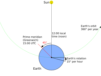
The calculation of noon can be made more easily and accurately with a small, exactly vertical rod driven into level ground—take the time reading when the shadow is pointing due north (in the northern hemisphere).
Although most recently only used by sextant hobbyists and historians, it is now becoming more common in celestial navigation courses to reduce total dependence on GNSS systems as potentially the only accurate time source aboard a vessel.
To make this correction, the navigator measures the altitudes of the Moon and Sun (or another star) at about the same time as the lunar distance angle.
The navigator then compares the corrected angle against those listed in the appropriate almanac pages for every three hours of Greenwich time, using interpolation tables to derive intermediate values.
Knowing UTC/GMT, a further set of sights can be taken and reduced by the navigator to calculate their exact position on the Earth as a local latitude and longitude.
The difference in arcminutes is the nautical mile "intercept" distance that the position line needs to be shifted toward or away from the direction of the body's subpoint.
One of the most common current uses of celestial navigation aboard large merchant vessels is for compass calibration and error checking at sea when no terrestrial references are available.
In 1980, French Navy regulations still required an independently operated timepiece on board so that, in combination with a sextant, a ship's position could be determined by celestial navigation.
[14] In October 2015, citing concerns about the reliability of GNSS systems in the face of potential hostile hacking, the USNA reinstated instruction in celestial navigation in the 2015 to 2016 academic year.
For small cruising boat crews, celestial navigation is generally considered an essential skill when venturing beyond visual range of land.
A variation on terrestrial celestial navigation was used to help orient the Apollo spacecraft en route to and from the Moon.
To this day, space missions such as the Mars Exploration Rover use star trackers to determine the attitude of the spacecraft.
As early as the mid-1960s, advanced electronic and computer systems had evolved enabling navigators to obtain automated celestial sight fixes.
These systems were used aboard both ships and US Air Force aircraft, and were highly accurate, able to lock onto up to 11 stars (even in daytime) and resolve the craft's position to less than 300 feet (91 m).
Intercontinental ballistic missiles use celestial navigation to check and correct their course (initially set using internal gyroscopes) while flying outside the Earth's atmosphere.
[22][23] SEXTANT (Station Explorer for X-ray Timing and Navigation Technology) is a NASA-funded project developed at the Goddard Space Flight Center that is testing XNAV on-orbit on board the International Space Station in connection with the NICER project, launched on 3 June 2017 on the SpaceX CRS-11 ISS resupply mission.
[24] Celestial navigation training equipment for aircraft crews combine a simple flight simulator with a planetarium.
[25][26] Housed in a 45-foot (14 m) high building, it featured a cockpit accommodating a whole bomber crew (pilot, navigator, and bombardier).
Fixed to a dome above the cockpit was an arrangement of lights, some collimated, simulating constellations, from which the navigator determined the plane's position.
Below the cockpit moved "terrain plates"—large, movable aerial photographs of the land below—which gave the crew the impression of flight and enabled the bomber to practice lining up bombing targets.
A team of operators sat at a control booth on the ground below the machine, from which they could simulate weather conditions such as wind or clouds.
The Link Celestial Navigation Trainer was developed in response to a request made by the Royal Air Force (RAF) in 1939.