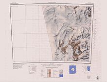
Flagship Mountain
The pillar is flanked to the west by steep blue ice and a huge windscoop from Flight Deck Neve and rises sheer from a large ice-free area to the north.
A pond in an enclosed basin on the rock flats 2 nautical miles (3.7 km; 2.3 mi) northwest of Flagship Mountain.
A group of small, rounded nunataks rising through the ice on the east side of Northwind Glacier, similar in appearance to a reef at sea.
The name was suggested by New Zealand geologist Christopher J. Burgess, leader of a 1976-77 VUWAE geological party to this locality, and refers to the matchless view of the surrounding area obtained from the summit of this mountain.
A small group of low rounded hills of a distinct red color, located 2.5 nautical miles (4.6 km; 2.9 mi) north of Mount Davidson.
The name was proposed in 1977 by New Zealand geologist Christopher J. Burgess in association with Viking Hills and because of the color resemblance to that of the planet Mars.
A range of low hills characterized by outcroppings of reddish granite in chocolate brown dolerite, situated between Flagship Mountain and Mount Davidson.