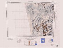
Benson Glacier
It was named by the party after Noel Benson, formerly professor of geology at the University of Otago, New Zealand, whose publications include a major contribution to the petrology of Victoria Land.
A thin, sinuous medial moraine that arcs smoothly for 6 nautical miles (11 km; 6.9 mi) from a point near Mount Razorback to beyond the far (northeast) side of Black Pudding Peak.
Charted by the British Antarctic Expedition (1910–1913) which named it for Professor Waldemar C. Brøgger, Norwegian geologist and mineralogist.
An extensive moraine in a valley beside the Benson Glacier, between Black Pudding Peak and Mount Brøgger.
An isolated black mountain located 2 nautical miles (3.7 km; 2.3 mi) northwest of Mount Brøgger.
A glacial slope distributary from Flight Deck Névé, 1.2 nautical miles (2.2 km; 1.4 mi) wide, that descends northwest over subdued steps between Dotson Ridge and Dory Nunatak.
An isolated sandstone nunatak, 1.2 nautical miles (2.2 km; 1.4 mi) long, rising above the southwest part of Flight Deck Névé, 1.5 nautical miles (2.8 km; 1.7 mi) southwest of Dotson Ridge.
So named by a 1989–1990 NZARP party because the feature appears to be sailing in the midst of the glacier névé like a small boat.
A ridgelike nunatak, 1.5 nautical miles (2.8 km; 1.7 mi) long, rising to 1,640 metres (5,380 ft) high in the northwest part of Flight Deck Névé.
Named by the New Zealand Northern Survey Party (1956–1957) of the CTAE after the USS Nespelen, one of the vessels of the American convoy to McMurdo Sound that season.
The high peak near the south end of the ridge from Mount Whitcombe, overlooking the lower Benson Glacier in Victoria Land.
So named because it was the final station occupied by the New Zealand Northern Survey Party of the CTAE (1956-58) during a particularly long day's field work on October 22, 1957.
A mountain over 1,200 metres (3,900 ft) high, standing at the head of Hunt Glacier, 2 nautical miles (3.7 km; 2.3 mi) northwest of Mount Marston.
[21] This article incorporates public domain material from websites or documents of the United States Geological Survey.