Beach evolution
Beach evolution is a natural process occurring along shorelines where sea, lake, or river water erodes the land.
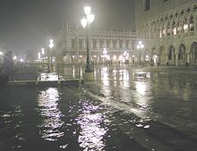
[1] Historically notable storm surges occurred during the North Sea Flood of 1953, Hurricane Katrina, and the 1970 Bhola cyclone.
Structurally controlled coasts include the San Andreas Fault zone in California and the seismic Mediterranean belt (from Gibraltar to Greece).
The tremors, which reached a peak on October 4, 1983, damaged 8,000 buildings in the city center and raised the sea bottom by almost 2 meters (6.6 ft).
[4] Deltas are nourished by alluvial systems and accumulate sand and silt, growing where the sediment flux from land is large enough to avoid complete removal by coastal currents, tides, or waves.
[5] This phenomenon is caused by the compaction of young sediments in the Po River delta area, magnified by subsurface water and gas exploitation.
There are numerous incidents of modern recession of beaches, mainly due to the longshore drift and coastal development hazards related to human activities.
"Move towards the sea" beach accretion can be facilitated by the four main type of hard engineering structures, namely seawall, revetment, groyne or breakwater.
Seawalls re-direct most of the incident energy in the form of sloping revetments, resulting in low reflected waves and much reduced turbulence.
Submerged seawalls or structures are constructed to create the underwater reefs to slow down wave energy and beach erosion.
Material builds up on the downdrift side, where littoral drift is predominantly in one direction, creating a wider and a more plentiful beach.
These are complex reinforced concrete objects, such as A-jack, Akmon, Dolos, Honeycomb sea wall (Seabees), KOLOS, Tetrapod and Xbloc.
Gabions are constructed by wiring boulders and rocks into mesh cages and placed in front of areas vulnerable to erosion, sometimes at cliffs edges or at right angles to the beach.
When the ocean lands on the gabion, the water drains through leaving sediment, while the structure absorbs a moderate amount of wave energy.
The imported sand should be of a similar quality to the existing beach material so it can meld with the natural local processes and without adverse effects.
This Integrated coastal zone management example is based on the "move beach seaward" general planning approach which involves both hard and soft engineering methods.
Seawall could be a mix of vertical structures in the areas where more space is needed and tapering revetments (slope) as aesthetic landscaping feature.
Different parts of revetment could have different material and design, such as gabion (welded wire mesh filled with stone, gravel and wood) and honeycomb seebee (made of concrete with hexagonal holes).
Other areas of seawall and revetment could be a mix of cemented low walls, gabion, riprap made of gravel or sand bags.
Restaurants could have retractable-canopied areas set closer to the seawall greenified with tapering layers of evergreen native tropical plants.
Seating could be relaxing-and-sprawling reclined futon type, sunken sand pits, sand filled bean bags on the beach, locally made designer stools/chairs and tables made of native eco-friendly natural material such as bamboo, aged rustic driftwood and abundant low weathering native wood.
Six to seven thousand years ago, the sea level stabilized, and continuous river systems, ephemeral torrents, and other factors began this steady accretion.
Since intense human use of coastal areas is a relatively recent phenomenon (except in the Nile delta), beach contours were primarily shaped by natural forces until the last centuries.
The port of Ephesus, one of the great cities of the Ionian Greeks in Asia Minor, was filled with sediment due to accretion from a nearby river; it is now 5 kilometers (3.1 mi) from the sea.
Likewise, Ostia, the once-important port near ancient Rome, is now several kilometres inland, the coastline having moved slowly seaward.
At the present time, important segments of low coasts are in recession, losing sand and reducing beach dimensions.
Many human activities, including dam construction and river channelization, have reduced the supply of sand that reaches the ocean.
This, in turn, has prevented beaches from being replenished and has thus created greater vulnerability for shorelines that have always been subject to varying levels of erosion.
There are few practical solutions to improving sand supply from inland sources, so management of shoreline erosion will likely continue to focus at the land/sea interface along the California coastline.
The massive building of dams in the Douro River basin has cut the sediment supply to the Aveiro coast, resulting in its recession.