Benton County, Minnesota
[4] It was named for Thomas Hart Benton, a United States Senator from Missouri.
The county seat moved to Watab in 1856 and returned to Sauk Rapids in 1859.
Sauk Rapids became the terminus of a railroad line in 1874, but was destroyed by a tornado in 1886.
Cloud expanded into a metropolitan area, the southern part of Benton County became a suburb.
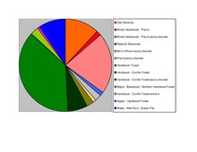
The terrain consists of low rolling hills, wooded or devoted to agriculture.
The county's highest point is a small hill near the midpoint of the northern border, 1 mi (1.6 km) north of Brennyville, at 1,311 ft (400 m) ASL.
[6] Benton County voters have tended to vote Republican for the past few decades.
In 2016 Donald Trump won the county with 64.2%, the highest share of the vote for any presidential candidate since Franklin D. Roosevelt in 1932.