Blackstaff River
[2] In earlier times the Blackstaff flowed into the Lagan immediately above the present-day Queen's Bridge at what is now Victoria Square,[3] and formed a wide, muddy estuary that extended as far up as Sandy Row.
[5] In the 17th century the situation of the Blackstaff became a problem for the newly built town of Belfast, which found its potential for expansion limited by the mud flats on its southern side.
[7] This work, commissioned by the Earl of Donegall during a lean period in order to provide relief for local labourers, allowed development to commence on the southern side of Ann Street, the original limit of the town.
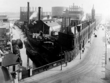
[8][6] In 1767, Henry Joy (whose family published the Belfast Newsletter) purchased a parcel of land at Cromac in order to build a paper mill, which would be powered by the Blackstaff.
[16] In particular on 16 August 2008, a newly opened underpass carrying the M1 motorway onto the A12 Westlink controversially flooded to a depth of 20 feet (6.1 m)[17] during heavy rain with water from the culverted Blackstaff and Clowney Rivers.