Brazil–Venezuela border
[1] The geographical boundary begins at the triple point between Brazil-Colombia-Venezuela at Cucuy Rock and continues up the Maturacá channel to the Huá waterfall; it then follows a straight line to the top of a mountain called Cerro Cupi.
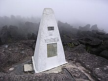
It then follows the crest of the drainage divide between the Orinoco and Amazon river basins up to the Brazil-Guyana-Venezuela border tripoint on top of Mount Roraima, thus covering a total of 2,199 kilometres (of which 90 km are conventional boundaries and the other 2,109 km correspond to the watershed between the basins of the Amazon (Brazil) and Orinoco (Venezuela)) through the Imeri, Tapirapecó, Curupira and Urucuzeiro mountain ranges (Brazilian state of Amazonas), and the Parima, Auari, Urutanim and Pacaraima ranges (State of Roraima), in the Guiana Shield.
The internationally recognized border is mostly located in remote and inaccessible wilderness areas, and it has only one road crossing, between the towns of Pacaraima (Brazil) and Santa Elena de Uairén (Venezuela), where the Brazilian BR-174 federal highway from Boa Vista and Manaus joins the Venezuelan Troncal 10 from Ciudad Guayana and Caracas.
[3][4] On February 22, 2019, amid the Venezuelan presidential crisis, President Nicolás Maduro closed the border to prevent international humanitarian aid from reaching Venezuela by land.
[6] On March 16, 2020, President Jair Bolsonaro partially closed the border with Venezuela because of the COVID-19 pandemic to slow the spread, as the epidemic has advanced in Brazil with 291 confirmed cases and the first death reported on Tuesday.