Bull Run River (Oregon)
The river, impounded by two artificial storage reservoirs as well as the lake, is the primary source of drinking water for the city of Portland, Oregon.
It is likely that Native Americans living along the Columbia River as early as 10,000 years ago visited the Bull Run watershed in search of food.
Within the past few thousand years they created trails over the Cascade Range and around Mount Hood, near the upper part of the Bull Run watershed.
However, turbidity increases when unstable soils sandwiched between layers of basalt and other volcanic rocks are disturbed and wash into the river during rainstorms.
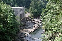
In the late 19th century, an unincorporated community, Bull Run, became established near the river in conjunction with a hydroelectric project and a related railroad line.
[6] The uppermost stream gauge on the main stem is at RM 20.9 (RK 30.6), 1 mile (1.6 km) downstream from the outlet structure at Bull Run Lake.
[18][19] Bull Run Lake is in a steep-sided cirque blocked at its lower end by a series of lava flows topped by debris from a glacial moraine.
"[18] Turbidity is sometimes a problem in Reservoirs 1 and 2 when unstable soils sandwiched between layers of lava erode into tributaries, especially the North and South forks.
[19] Archeological evidence suggests that Native Americans lived along the lower Columbia River as early as 10,000 years ago.
The Indians established villages on floodplains and traveled seasonally to gather huckleberries and other food on upland meadows, to fish for salmon, and to hunt elk and deer.
One of the first documented visits to the upper Sandy occurred in 1838, when Daniel Lee drove cattle from the Willamette Valley to Wascopam via the Indian trail over Lolo Pass.
The committee, led by Henry Failing, commissioned Isaac W. Smith, an engineer and surveyor, to inspect any viable water supply in the region.
[23] In 1892, U.S. President Benjamin Harrison signed a proclamation creating a protected area, the Bull Run Reserve, in the watershed.
Access improved in mid-1911, when the company finished construction on a 22-mile (35 km) railway line between the Montavilla neighborhood in east Portland and Bull Run.
[37] PGE, a corporation with home offices in Portland, has many other sources of electricity, which it sells to customers in a 4,000-square-mile (10,000 km2) service area in the northern Willamette Valley.
[39] Extensive timber cutting in the Sandy River basin began in the mid-19th century in response to a demand for wood from the Portland metropolitan area.
Logging intensified in the lower basin through the 20th century as sawmills became established in Sandy, Boring, Brightwood and other settlements in the region, and railroad spurs extended into the forests.
[41] Except for activity related to the waterworks, the protected area changed little until the 1950s, when the United States Forest Service began to advocate logging in the Reserve.
[42] In 1973, Joseph Miller, Jr., a retired Portland physician, sued the Forest Service, claiming that its logging violated the Bull Run Trespass Act.
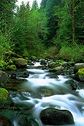
[45] The Bull Run watershed drains 139 square miles (360 km2),[5] most of which is in the Mount Hood National Forest in Multnomah and Clackamas counties in northwest Oregon.
The confluence of the Bull Run and Sandy rivers at Dodge Park, about 20 miles (32 km) east of downtown Portland,[16] marks the watershed's western (downstream) end, while on the east it borders Hood River County, and at Hiyo Mountain it is about 6 miles (9.7 km) northwest of Mount Hood in the Cascade Range.
[49] Small portions of the watershed that are along the lower main stem or along tributaries are partly outside the BRWMU and fall under other jurisdictions.
These include Eagle, Tanner, Moffett, McCord, Horsetail, Oneonta, Multnomah, and Bridle Veil creeks, which plunge over one or more waterfalls as they enter the Columbia Gorge.
[51] A study published in 1982 suggested that standard rain gauges placed in open areas might be underestimating the contribution of fog drip to heavily forested parts of the watershed by up to 30 percent.
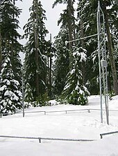
At the Blazed Alder Creek station, the highest of the three at 3,650 feet (1,110 m) above sea level, the mean snow-water equivalent (SWE) (the amount of water in the accumulated snow) ranged in 2009 from 0 in July–October to about 50 inches (1,300 mm) in April.
[54] A station on the North Fork at an elevation of 3,060 feet (930 m) reported a minimum mean SWE of 0 in July–October 2009 and a maximum of about 37 inches (940 mm) in April.
It includes parts made of wrought iron as well as steel, and its truss portals incorporate nautical design elements meant for Portland, an inland seaport.
[61] More than 250 wildlife species, including peregrine falcon, bald eagle and northern spotted owl are thought to frequent the watershed.
[68] Access to the Bull Run Watershed Management Unit is generally limited to government employees and guests on official business, and security guards keep watch on its three gated entrances.
[69] However, the water bureau offers public tours in the summer and fall,[70] and hikers may use the Pacific Crest Trail, which runs along the eastern edge of the watershed near Mount Hood.