Business routes of Interstate 10
These roads typically follow along local streets often along a former US route or state highway that had been replaced by an Interstate.
Along Interstate 10 (I-10), business routes are found in the four westernmost states through which I-10 passes: California, Arizona, New Mexico, and the far western region of Texas beyond the Pecos River.
Although I-10 is a transcontinental highway, none of the states to the east along the Interstate have yet to designate I-10 business routes.
Each state highway department internally uses its own designations to identify segments within its jurisdiction.
Local authorities may request route assignment from the Caltrans Transportation System Information Program, and all requests require approval of the executive committee of the American Association of State Highway and Transportation Officials (AASHTO).
The route turns to the east along Hobsonway through town, then crosses underneath I-10 just before the Colorado River at the Arizona state line and emerges from the underpass as Riviera Drive where the route reconnects with I-10 at exit 243.
Individual loops along an Interstate are designated by adding parenthetical numbers that increase eastward and northward.
Gaps in numbering represent removal of former routes or potential expansion.
Many of the business loops are sections of highways which preceded I-10, such as US 60, US 70, US 80 and Arizona State Route 86 (SR 86).
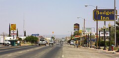
is a business loop of I-10 at Quartzsite in La Paz County operated since 1991.
The 2.9-mile (4.7 km) route, which follows along the local streets Quartzsite Boulevard, Main Street, and Riggles Avenue, begins at exit 17 of I-10 and US 95 west of town and ends at exit 24 of I-10 east of town.
Between its termini, the route has a major intersection with SR 95 where it ends a concurrency with US 95.
was a business loop of I-10 at Phoenix, in Maricopa County, decommissioned circa 1990.
Prior to its decommissioning, the route began at I-10 exit 142 (27th Avenue), heading south before turning east at Van Buren Street.
[7] The 44th Street leg of the Phoenix I-10 BL has since been replaced by part of the Hohokam Expressway (SR 143).
Between its termini, the route made a quick jog down Irvington Road near Tucson Boulevard to stay on Benson Highway and used a small section of Valencia Road at the end of Benson Highway to access exit 267.
The 0.6-mile (1.0 km) route followed Ocotillo Road south from I-10 before ending at 4th Street (I-10 BL) west of downtown Benson.
[23] Between its termini, the route has major intersections with US 70 and New Mexico State Road 494 (NM 494).
Along Texas Interstates, the alphabetic suffixes on business route names ascend eastward and northward.
The alphabetic naming suffixes are included as small letters on the bottom of reassurance shields.
[29] The route has one major intersection with Ranch to Market Road 1111 (RM 1111) to Cornudas and Dell City.
After October 15, 1965, the road was designated Texas State Highway Loop 416, although it was signed as a business route of US 80.
The 2.9-mile (4.7 km) route, which follows along Ross Drive and Broadway Boulevard in Van Horn, begins at exit 138 on I-10 west of town and ends at exit 140B on I-10 east of town.
On November 25, 1975, the road was designated Texas State Highway Loop 519, although it was signed as a business route of US 80.
The route begins at exit 206 on I-10 and Farm to Market Road 2903 (FM 2903, Fort Worth Street) north of town and ends at exit 209 on I-10 and SH 17 (Main Street) east of the small community of Brogado.
This section brings the total length of the road to 4.6 miles (7.4 km).