Interstate 10 in Florida
The highway runs east from the Alabama border, traveling through the Panhandle of Florida, serving the major cities of Pensacola, Tallahassee, Lake City, ending at Jacksonville, and carries the hidden Florida Department of Transportation (FDOT) designation of State Road 8 (SR 8).
On the border between Brent and Ensley, the median approaching exits 10A and 10B becomes unexpectedly wide in order to accommodate flyover on-ramps from US 29 that enter the left sides of the road.
The road crosses the border between the Central and Eastern time zones at the long Dewey M. Johnson Bridge, over the Apalachicola River.
East of the bridge over the Ochlockonee River and the rest areas that follow, I-10 widens from four to six lanes and remains that way until after the interchange with SR 61 and US 319 in Tallahassee.
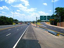
Like at US 29 in Escambia County, the median for I-10 widens in the vicinity of I-75 at exits 296A and 296B, near Lake City, in order to accommodate flyover on-ramps that enter from the left sides of the road.
US 17 overlaps I-10 for two exits before the eastern terminus of the Interstate, located in the Brooklyn neighborhood of Jacksonville's urban core at I-95.
The segment between Chipley and Midway was completed in 1977 except for a small portion between Kynesville and Oakdale; in 1978, the entire length of I-10, as well as the I-110 spur in Pensacola across the state opened along its original planned route.
[7] On September 16, 2004, Hurricane Ivan made landfall near Pensacola, with the resulting storm surge causing heavy damage to the I-10 bridge across Escambia Bay.
[8] A $26.5 million project was awarded the following day to Gilbert Southern/Massman and to the Parsons Corporation to make emergency repairs to the bridge.