Carlsbad, California
[8][9] Carlsbad's history began with the Luiseño people (the Spanish name given to them because of their proximity to Mission San Luis Rey), as well as some Kumeyaay in the La Costa area.
[10] The first European land exploration of Alta California, the Spanish Portolá expedition of 1769, met native villagers while camped on Buena Vista Creek.
[12] During the Mexican period, in 1842, the southern portion of Carlsbad was granted as Rancho Agua Hedionda to Juan María Marrón.
[13] To take advantage of the find, the Carlsbad Land and Mineral Water Company was formed by a German-born merchant from the Midwest named Gerhard Schutte together with Samuel Church Smith, D. D. Wadsworth and Henry Nelson.
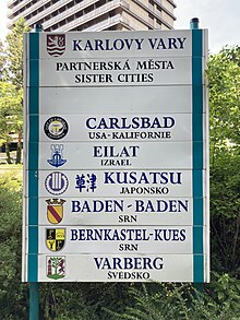
The site of John Frazier's original well can still be found at Alt Karlsbad, a replica of a German Hanseatic house, located on Carlsbad Boulevard.
[16] It was located on the grounds of Carlsbad Raceway and was designed and built by inventors Jack Graham and John O'Malley.
[22] Construction of the Carlsbad Desalination Plant at Encina Power Station was completed in December 2015.
The ocean-side cliffs fronting wide white-sand beaches and mild climate attract vacationers year-round.
[26] Carlsbad has a semi-arid Mediterranean climate (Koppen classification BSh) and averages 263 sunny days per year.
For city planning and growth management purposes, Carlsbad is divided into four distinct quadrants.
Homes range from 1950s cottages and bungalows, 1960s ranch style houses, to elegant mansions on hills overlooking the ocean.
[30] It is the site of the Centro de Aprendizaje, a Spanish division of the Carlsbad City Library.
[31] This quadrant (ZIP code 92010) is located east of El Camino Real and north of Palomar Airport Road and consists mostly of single-family homes, with larger lots found in the older area known as Chestnut Hills and the newer developments around Calavera Hills.
The preserve — notable for its small lake, wide dam, and mountain — was officially set aside in the 1990s as the surrounding land was being developed.
In 2012, Sage Creek High School was developed in the southwest corner of the preserve amid some controversy.
Despite missing one of its original corners, the preserve still offers miles of hiking trails with ocean views.
[32] The southeast quadrant (ZIP code 92009) is located east of El Camino Real and south of Palomar Airport Road and features several newer expensive master-planned communities set among hillsides, golf courses, Alga Norte Community Park and permanent open spaces.
This quadrant (ZIP code 92011) extends along the Pacific Ocean to the south of the center of Carlsbad.
Carlsbad is part of the San Diego-Chula Vista-Carlsbad, CA Metropolitan Statistical Area.
[46] In May 2018, the Carlsbad city council voted 4–1 to back the federal government's lawsuit against California sanctuary state law SB 54.
[50] Carlsbad was a powerfully Republican stronghold during the 20th century, a classic bastion of suburban conservatism in Southern California.
In 2016, the city flipped back to the Democratic Party, voting for Hillary Clinton by a 10.4% margin over Donald Trump.
In 2013, Google named Carlsbad the digital capital of California with the strongest online business community.
[71] Interstate 5 runs through the western part of Carlsbad, while California State Route 78 passes close to its northern border.
McClellan–Palomar Airport is located about 7 miles (11 km) southeast of downtown Carlsbad, and allows general aviation and limited commercial service to the city.