Ocean Networks Canada
ONC operates unparalleled observatories in the deep ocean and coastal waters of Canada’s three coasts–the Arctic, the Pacific and the Atlantic–gathering biological, chemical, geological and physical data to drive solutions for science, industry and society.
Additionally, Ocean Networks Canada operates smaller community-based observatories offshore from Cambridge Bay, Nunavut.,[1] Campbell River, Kitamaat Village and Digby Island.
A shallow sill (70 m) at the mouth isolates the deep basin (215 m) that experiences seasonal deep-water anoxia as a result of high primary productivity and subsequent degradation of sedimented organic matter.
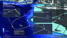
Patricia Bay installations include: A network with three sites on seafloor at Central, East and Fraser Delta[16] locations of the southern Strait of Georgia, and surface-based systems on BC Ferries, Iona Causeway, and Coal Port terminal.
A number of fish including sablefish, thornyheads, rockfish, flatfish, sharks, skates, hagfish and eelpouts have been observed throughout Barkley Canyon.
Cnidarians are seen both on the seafloor (anemones, sea pens, and corals) as well as floating in the water column (jellyfish) along with other organisms such as salps, ctenophores, and tunicates.
[17] Where gas hydrates are observed on the seafloor, there are mats of chemosynthetic bacteria which derive their energy from hydrogen sulphide produced by the oxidate of methane by a second group of microbes living deep within the sediments.
The Cascadia Basin site is placed in the vicinity of several circulation obviation retrofit kit (CORK) borehole observatories, which are designed to study the hydrology, geochemistry and microbiology of the upper oceanic crust.
This is a zone where much of the thick layer of sediments deposited on the eastern flank of the Juan de Fuca Ridge are scraped off and accreted as the tectonic plates converge (move together).
At these divergent boundaries, convection currents in the mantle rise up as magma, emerge through the rifts as lava, and crystallise as new rock (basalts and gabbro).
As the cool seawater moves through the sediment and rock towards the hot magma, the water becomes super heated (300-400 °C) and rich in dissolved mineral elements (such as sulphur, iron, zinc and copper) from the young ocean crust.
While most of the deep sea depends on near-surface productivity with photosynthesis as its fundamental energy source, vent communities are completely independent from the surface and sunlight.
The tubeworm Ridgeia piscesae grows in large colonies in diffuse venting areas, supported by the symbiotic chemosynthetic bacteria developing in their cells.
Estuarine circulation from Barkley Sound is influenced by the shelf dynamics of an eastern boundary current, creating a complex physical environment.
Surface outflow drives a deep water inflow which is strongly influenced by upwelling and downwelling conditions on the nearby continental shelf.
Since this is a rockfish conservation area, there is a wide variety of rockfish (yellowtail, China, quillback, Puget Sound, black, and blue) in addition to many other fish (kelp greenling, lingcod, flatfish, wolfeels), molluscs (giant Pacific octopus, mussels, swimming scallops, and snails), and echinoderms (seastars, sea cucumbers, and urchins).
An echosounder installed at Folger Deep shows evidence of a dense zooplankton community and schools of fish in the water column, while hydrophones regularly record the songs of whales and dolphins in the area.