Charles Preuss
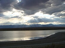
George Karl Ludwig Preuss (1803–1854), anglicized as Charles Preuss, was a surveyor and cartographer who accompanied John C. Fremont on three of his five exploratory expeditions of the American west, including the expedition where he and Fremont were the first to record seeing Lake Tahoe from a mountaintop vantage point as they traversed what is now Carson Pass in February 1844.
They hit the Old Spanish Trail at present Victorville, California, then went northeast to Bent’s Fort on the Arkansas River, and returned to Westport, Missouri.
On seven sheets he carefully traced the Oregon Trail, using Frémont's narrative to indicate campsites with essential grass, wood, and water and to show distances, climate, and Indian inhabitants.
Widely popular among those who took the Platte River road to Oregon and California, this annotated atlas was one of the greatest contributions Frémont and Preuss made to the development of the West.
"[4] Congress commissioned to Preuss create a third map in 1848, this time using information from records kept by Lt. Kern who was the topographer on Fremont's third expedition.
In 1848 Preuss agreed to accompany Fremont on his fourth expedition, which ended in disaster with the death of 10 men and two more that tried to rescue the group that were caught high in the Rockies during the winter.
They surveyed south through the Tulare Lake area, Greenhorn Mountains, and Tehachapi Pass to the Mohave Desert, and finished in San Diego in December 1853.
[5] : 351 Furthermore, research on the Pacific Railroad Surveys and associated political intrigues in Washington, DC, reveal the intense pressures that Preuss may have felt by 1854.
The topographer became caught between his competing patrons: War Secretary Jefferson Davis, on one hand, and Fremont and Thomas Hart Benton, on the other, as the two sides fought to secure their preferred railroad route through the mountains of Southern California.
Hassler recommended Preuss to John Charles Fremont, a young 2nd lieutenant who was preparing an expedition exploring the lands between the Mississippi and Missouri Rivers.