Tulare Lake
[2] For thousands of years, from the Paleolithic onward, Tulare Lake was a uniquely rich area, which supported perhaps the largest population of Native Americans north of present-day Mexico.
[3] In the second half of the 19th century, Tulare Lake was dried up by diverting its tributary rivers for agricultural irrigation and municipal water uses.
The lake was part of a 13,700-square-mile (35,400 km2) partially endorheic basin, at the south end of the San Joaquin Valley, where it received water from the Kern, Tule, and Kaweah Rivers, as well as from southern distributaries of the Kings.
[8] It was separated from the rest of the San Joaquin Valley by tectonic subsidence and alluvial fans extending out from Los Gatos Creek in the Coast Ranges and the Kings River in the Sierra Nevada.
Above a threshold elevation of 207 to 210 feet (63 to 64 m), it overflowed northward into the then-extant Summit Lake (southwest of Riverdale), thence via Fresno Slough to the San Joaquin River.
Pelican Island was formed from deposits of the Kings River as an extension of its east channel, about a mile long and ten to sixty feet wide in 1883.
Dr. William Ferguson Cartmill, who numerous streets are named after in Tulare County, took several skulls from the site and kept them in his house.
[14] Indigenous fauna of the Sand Ridge area include Buena Vista Lake shrew (Sorex ornatus relictus), southwestern pond turtle (Actinemys pallida), fulvous whistling duck (Dendrocygna bicolor), least bittern (Ixobrychus exilis), California red-legged frog (Rana aurora draytonii), giant garter snake (Thamnophis gigas).
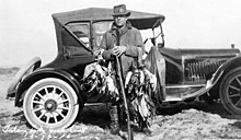
[16] Historically attested species (sometimes present in nearby placenames) like the tule elk and pronghorn antelope were of economic importance to Native American peoples living in the area.
[19] According to the Bureau of Land Management, Sand Ridge "has yielded artifacts spanning the entire cultural horizon in California.
[9] In 1816, Luís Antonio Martinez destroyed the rancheria of Bubal, burning the village, scattering their grain, and smashing their grinding stones.
[21] According to Frank F. Latta, there was an epidemic around 1833 that wiped out nearly the entire western San Joaquin Valley: At least three centenarians among my Yokuts informants were children here at that time.
[22] Skull Island was probably a result of this epidemic, as Latta's informants specifically note that bodies were too high in quantity for the living to bury them.
John C. Frémont led a United States military expedition across California, including Tulare Lake, immediately before the Mexican-American War.
In 1858 or 1859, settlers began ethnically cleansing Tulare Lake, by killing or forcibly relocating the majority of the Yokuts population.
Severe floods in 1861 and 1867 killed thousands of cattle and caused settlers to request further dams on the inflows to Tulare Lake.
In 1884, Scottish travel writer Constance Gordon-Cumming warned that "[e]ven the great Tulare lake itself is in danger of being gradually absorbed by the numerous canals and ditches with which the whole country is now being intersected...[t]he poor lakes have simply been left to starve—the rivers, whose surplus waters hitherto fed them, having now been bridled and led away in ditches and canals to feed the great wheat-fields.
[28] The Kaweah, Kern, Kings, and Tule Rivers were dammed upstream in the Sierra Nevada Mountains, which turned their headwaters into a system of reservoirs.
Swedish naturalist Gustav Eisen, who crossed the lake by steamboat in 1878 and undertook an excavation of Sand Ridge probably that same year, celebrated the desiccation.
[30] The lake bed became a shallow basin of fertile soil, within the Central Valley of California, the most productive agricultural region of the United States.
Farms in the basin produce much of the country's cotton, tomatoes, pistachios, almonds, walnuts, alfalfa, wheat, barley and cow milk.
[33][34] Estimates have found that Tulare Lake could hold twice the water of the proposed Temperance Flat Dam at one-fifth the cost.
[35] The Tachi Yokuts and many other people and organizations are trying to restore the lake permanently for various reasons including environmental purposes, water storage and Native American land reclaiming.
[44] In June 1998, an above-normal winter snowfall led to the lake reappearing, reaching a size of 20,000 acres (81 km2), which resulted in about $100 million worth of crop damage and losses.
[41] The groundwater in recent years has been overpumped by the large land owners that dominate the politics and economy of the Tulare Lake region.
The overpumping has contributed to the sinking of the ground under Corcoran, as well as exacerbated the dangers of flooding and necessitated the construction of multimillion-dollar levees.
Boswell Company’s achievements and variety of California's agricultural industry titled The Big Land directed by David H. Vowell was released.
[54] TV personality Huell Howser visited Tulare Lake in an episode of his show, California's Gold, in 1999.