Climate of California
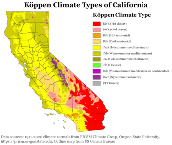
The climate of California varies widely from hot desert to alpine tundra, depending on latitude, elevation, and proximity to the Pacific Coast.
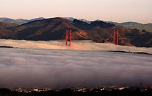
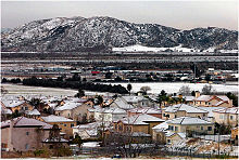
The influence of the ocean generally moderates temperature extremes, creating warmer winters and substantially cooler summers in coastal areas.
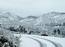
Farther inland, the climate becomes more continental, with some areas turning semi-arid (Köppen BSk), with colder winters and markedly hotter summers.
In the northern portion of the Mojave Desert on the east side of the state is Death Valley, which has recorded temperatures among the highest in the world.
The prevailing westerly winds from the oceans also bring moisture, and the northern parts of the state generally receive higher annual rainfall amounts than the south.
During the El Niño phase, the jet stream is located south through California, allowing for warmer temperatures and more heavy rains to occur, particularly in the southern portions of the state.
During the La Niña phase, the jet stream is much further north, and therefore the far northern portions of California are wetter, while the southern half stays cool and dry.
On November 3, 2007, a sudden patch of dense fog along California State Route 99 (SR 99) resulted in a traffic crash involving 108 vehicles in Fresno, which killed two people and at least 36 injuries.
Following the accident, the California Department of Transportation (Caltrans) developed a fog warning system along a 13 mi (21 km) section of SR 99.
[55][56] Across the state, tornadoes develop in three main regions – the Los Angeles area, the deserts of Southern California, the Central Valley.
[57][58] Because of their irregular and short-lived nature, the San Diego National Weather Service considers it "nearly impossible to forecast a Southern California tornado before it touches down."
[58] In July 2004, a twister touched down in Sequoia National Park at an altitude of around 12,156 ft (3,705 m), making it the highest elevation for a confirmed tornado in the United States.