Climate of India

India's geography and geology are climatically pivotal: the Thar Desert in the northwest and the Himalayas in the north work in tandem to create a culturally and economically important monsoonal regime.

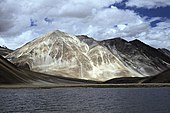
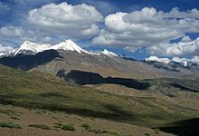
As Earth's highest and most massive mountain range, the Himalayas bar the influx of frigid katabatic winds from the icy Tibetan Plateau and northerly Central Asia.

As in much of the tropics, monsoonal and other weather patterns in India can be strongly variable: epochal droughts, heat waves, floods, cyclones, and other natural disasters are sporadic, but have displaced or ended millions of human lives.

Ongoing and future vegetative changes, sea level rise and inundation of India's low-lying coastal areas are also attributed to global warming.

During the Late Paleozoic, Gondwana extended from a point at or near the South Pole to near the equator, where the Indian craton (stable continental crust) was positioned, resulting in a mild climate favorable to hosting high-biomass ecosystems.

Elevated carbon dioxide emissions also contributed to the greenhouse effect, causing warmer weather that lasted long after the atmospheric shroud of dust and aerosols had cleared.

Further climatic changes 20 million years ago, long after India had crashed into the Laurasian landmass, were severe enough to cause the extinction of many endemic Indian forms.

[8] The formation of the Himalayas resulted in blockage of frigid Central Asian air, preventing it from reaching India; this made its climate significantly warmer and more tropical in character than it would otherwise have been.

[9] More recently, in the Holocene epoch (4,800–6,300 years ago), parts of what is now the Thar Desert were wet enough to support perennial lakes; researchers have proposed that this was due to much higher winter precipitation, which coincided with stronger monsoons.

[13] The Himalayas, along with the Hindu Kush mountains in Pakistan, prevent cold Central Asian katabatic winds from blowing in, keeping the bulk of the Indian subcontinent warmer than most locations at similar latitudes.

[14] Simultaneously, the Thar Desert plays a role in attracting moisture-laden south-west monsoon winds between June and October, which provide the majority of India's rainfall.

Noticeably drier than areas with a tropical monsoon type of climate, it prevails over most of inland peninsular India except for a semi arid rain shadow east of the Western Ghats.

In northwestern India region, virtually cloudless conditions prevail in October and November, resulting in wide diurnal temperature swings; as in much of the Deccan Plateau, they register at 16–20 °C (61–68 °F).

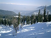
The mountain ranges prevent western winter disturbances in Iran from travelling further east, resulting in much snow in Kashmir and rainfall for parts of Punjab and northern India.

[14] The region averages 800 millimetres (31 in) Summer in northwestern India starts from April and ends in July, and in the rest of the country from March to May but sometimes lasts to mid June.

Hill stations, such as Ootacamund ("Ooty") in the Western Ghats and Kalimpong in the eastern Himalayas, with average maximum temperatures of around 25 °C (77 °F), offer some respite from the heat.

The southwest summer monsoon, a four-month period when massive convective thunderstorms dominate India's weather, is Earth's most productive wet season.

[38] A product of southeast trade winds originating from a high-pressure mass centred over the southern Indian Ocean, the monsoonal torrents supply over 80% of India's annual rainfall.

[39] Attracted by a low-pressure region centred over South Asia, the mass spawns surface winds that ferry humid air into India from the southwest.

The void left by the jet stream, which switches from a route just south of the Himalayas to one tracking north of Tibet, then attracts warm, humid air.

[42] This is accompanied by a seasonal excursion of the normally equatorial intertropical convergence zone (ITCZ), a low-pressure belt of highly unstable weather, northward towards India.

[41] This system intensified to its present strength as a result of the Tibetan Plateau's uplift, which accompanied the Eocene–Oligocene transition event, a major episode of global cooling and aridification which occurred 34–49 Ma.

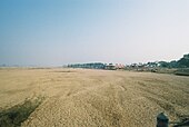
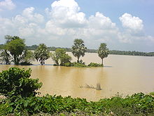
Though they provide rice paddy farmers with a largely dependable source of natural irrigation and fertilisation, the floods can kill thousands and displace millions.

Mean annual precipitation totals have remained steady due to the declining frequency of weather systems that generate moderate amounts of rain.

Widespread death and property destruction are reported every year in the exposed coastal states of West Bengal, Orissa, Andhra Pradesh, and Tamil Nadu.

India's western coast, bordering the more placid Arabian Sea, experiences cyclones only rarely; these mainly strike Gujarat and Maharashtra, less frequently in Kerala.

This is particularly true of major drought-prone regions such as southern and eastern Maharashtra, northern Karnataka, Andhra Pradesh, Western Orissa, Gujarat, and Rajasthan.

The average annual precipitation of 11,861 millimetres (467 in) in the village of Mawsynram, in the hilly northeastern state of Meghalaya, is the highest recorded in Asia, and possibly on Earth.

[82] India's highest recorded one-day rainfall total occurred on 26 July 2005, when Mumbai received 944 mm (37 in);[83] the massive flooding that resulted killed over 900 people.

Dust and black carbon, which are blown towards higher altitudes by winds at the southern margins of the Himalayas, can absorb shortwave radiation and heat the air over the Tibetan Plateau.

A scene in Uttarakhand 's Valley of Flowers National Park . In contrast to the rain shadow region of Tirunelveli, the park receives ample orographic precipitation due to its location in a mountainous windward -facing region wedged between the Zanskars and the Greater Himalayas .
Daytime view of a chain of snow-capped mountains. They advance diagonally thumb from the far-middle distance at left to the nudge distance at right. In the foreground are high montaine meadows and brushband.
The formation of the Himalayas (pictured) during the Early Eocene some 52 mya was a key factor in determining India's modern-day climate; global climate and ocean chemistry may have been affected. [ 1 ]
Many areas remain flooded during the heavy rains brought by monsoon in West Bengal
"India Average Temperature Map": A map of India overlaid with five zones. A violet zone, with ambient temperatures averaging less than 20.0 degrees Celsius, envelops Himalayan and trans-Himalayan India, as well as the Khasi Hills on the Meghalaya Plateau. A transitionary blue zone of between 20.0 and 22.5 degrees, lies just south of the violet areas; another blue area lies in the extreme southwest of the country, focused on the high Western Ghats. Two contiguous green areas (averaging 22.5 to 25.0 degrees) envelop the blue regions, with the northern one snaking into the Vindhya Range of central India. The remaining yellow and red areas, designating average temperatures above 25.0 degrees Celsius, constitute by far the greater part of the country.
Average annual temperatures across India:
< 20.0 °C
(< 68.0 °F)
20.0–22.5 °C
(68.0–72.5 °F)
22.5–25.0 °C
(72.5–77.0 °F)
25.0–27.5 °C
(77.0–81.5 °F)
> 27.5 °C
(> 81.5 °F)
India's Köppen climate classification map [ 12 ] is based on temperature, precipitation and their seasonality.
Dust storm in the Thar Desert
Daytime view of a large body of water standing before a prominent peak, which communicates with several others partly out of view and behind. A gravel beach at the far end of the lake gives way to steep slopes leading up to the peaks; The mountains lack trees. Patchy snowcover defines their recesses, and whitish vein-like streaks extend up from the base of the largest.
Pangong Lake in Ladakh , an arid montane region lying deep within the Himalayas.
Daytime view of a small marshy lake surrounded by dry brush in winter. Behind the lake in the far-middle distance, a large stand of trees interposes itself in front of a lone massif in the far distance. The sun is out of view to the left.
A winter scene in Bandhavgarh National Park , Madhya Pradesh.
Daytime view looking down from a snowy ridge onto a mountain valley far below, lost in mist. Continuing into the far distance at right, a series of high snow-covered mountains continue the ridge. The mountains are mostly covered in evergreen forest; dappled sunlight strikes the snow cover.
Inclement conditions in the Indian Himalayas: a view of Gulmarg , a popular tourist destination in Jammu and Kashmir in winter.
Late daytime view looking far out over an ocean from a beach, which is out of view off the bottom margin. Three-fourths of the shot features a sky marked by heavy cloud cover, which is parting near the middle, revealing a dazzlingly bright cerulean blue sky that darkens near the margins. The ocean is striated with waves coming in parallel to the horizon.
Late-season monsoonal sunset, Coromandel Coast .
Daytime sunlit view of a verdant bowl-shaped meadow with a small pond in a valley rimmed by several prominent hills covered in evergreen forest. At centre-left and looking out on the meadow, a small cluster of tourist lodges with pitched roofs, one a bright red. Around them and the pond are small, gaily coloured gazebos and shade-giving umbrellas. Several dozen tourists and sheep mill about the pond and in the meadow.
A summer view of Khajjiar , a hill station in Himachal Pradesh.
Fishing boats parked in the Anjarle creek for the monsoon season. Fishing in the coastal areas is not possible now due to the harsh weather conditions.
Daytime view over a city: de-laminating concrete housing blocks surrounded by rough slum tenements. In the middle distance, an expanse of trees: perhaps a park. Near the horizon, the largely concrete structures that compose the city continue. The whole is enveloped by an ominous sky filled with storm clouds promising imminent heavy rain.
Pre-monsoon clouds, as they appear in Mumbai , western Maharashtra.
Relief efforts by the Indian Navy in Chennai
Vardah making landfall at the coast of Chennai, India.
Satellite view looking over the Bay of Bengal, deliminated by India to its west, Bangladesh to its north, and Indochina to its west. Various patches of substantial storm tracts define the southern margins of the shot, but a larger buzzsaw-shaped whorl of clouds sits above the northern Bay, just beginning to impact parts of Orissa, West Bengal and Bangladesh.
Satellite imagery of Cyclone 05B in the Bay of Bengal .
A daytime view of a desiccated, scappled expanse that wholly fills the fore- and middle ground and arcs away to the horizon at left. Of clouds in the sky there are none whatever. At extreme right in the middle distance, a thin bank of trees sits on a slightly higher level, reaching to the middle and rightward horizon; people and livestock mill about before them. Several pink buildings, perhaps a village, sit similarly elevated in front of the trees at middle-right, beyond the dominating dusty expanse.
The dry bed of the Niranjana River, Bihar.
The highest plunge waterfall/ heavy rainfall in Karnataka a state of India
Satellite view of the northern portion of South Asia. The arc of a substantial range of mountains, the Himalayas, dips into the shot, then back up out of view. Immediately beneath, a large region of plains is hidden by a continuous cloud-like opaque mass that has collected along the southern margins of the mountains. It proceeds eastward, staying just south of the Himalayas, then bends due south to reach the Bay of Bengal. Two parts of the mass appear particularly dense, showing up as bright white blobs in the shot.
Clouds of thick haze and smoke may form over the Ganges river basin. This image was captured at 10:50 IST on 17 December 2004. [ 95 ]