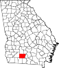
Colquitt County, Georgia
[2] The county was created on February 25, 1856, and is named for Walter Terry Colquitt, a U.S.
[3] Colquitt County comprises the Moultrie, GA micropolitan statistical area.
Most of the western portion of Colquitt County, west of Moultrie and State Route 33, is located in the Upper Ochlockonee River sub-basin of the larger Ochlockonee River basin, with the exception of the very northwestern corner of the county, between Sale City and west of Doerun, which is located in the Lower Flint River sub-basin of the ACF River Basin (Apalachicola-Chattahoochee-Flint River Basin).
A narrow central portion of Colquitt County, running from north to south of Moultrie, and then widening to occupy the gap between U.S. Route 319 and State Route 133, is located in the Withlacoochee River sub-basin of the Suwannee River basin.
[5] As of the 2020 United States census, there were 45,898 people, 15,505 households, and 10,663 families residing in the county.