Columbia River Gorge
Up to 4,000 feet (1,200 m) deep, the canyon stretches for over eighty miles (130 km) as the river winds westward through the Cascade Range, forming the boundary between the state of Washington to the north and Oregon to the south.
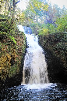
The Columbia River Gorge marks the state line between Oregon and Washington, and its wide range of elevation and precipitation makes it an extremely diverse and dynamic place.
The gorge transitions between temperate rainforest to dry grasslands in only 80 miles (130 km), hosting a dramatic change in scenery while driving along Interstate 84.
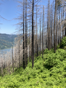
In the transition zone (between Hood River and The Dalles), vegetation turns to Oregon white oak, ponderosa pine, and cottonwood.
It also creates the right conditions for snow and ice storms during the winter months which also draw very cold east winds toward the mouth of the gorge on the west end.
During this period the Cascade Range was forming, which slowly moved the Columbia River's delta about 100 miles (160 km) north to its current location.
Native Americans would travel through the gorge to trade at Celilo Falls, both along the river and over Lolo Pass on the north side of Mount Hood.
[7] The experimental designation came in lieu of being recognized as a national park, which would require the existing industries in towns along the river to relocate.