Cornubian batholith
The Cornubian batholith is a large mass of granite rock, formed about 280 million years ago, which lies beneath much of Cornwall and Devon in the South West Peninsula of England.
The main exposed masses of granite are seen at Dartmoor, Bodmin Moor, St Austell, Carnmenellis, Land's End and the Isles of Scilly.
From gravity and magnetic geophysical data, the batholith is interpreted to extend from about 8°W, more than 100 km southwest of the Isles of Scilly, to the eastern edge of Dartmoor.
Comparisons with other examples would suggest that the thicknesses of the individual plutons would be in the range 3–5 km, based on their outcrop widths.
[4] As the molten rock cooled to around 1000 Celsius it solidified and crystallised and fractures along vertical joints formed.
[5] An approximate age of emplacement for the Cornubian batholith was known before radiometric dating methods became commonplace, from the observed relationships with the sedimentary rocks – both those which formed before the intrusion and those which were laid down after it.
The youngest rocks into which the granites intrude are the Carboniferous Crackington and Bealsmill formations of Namurian to lower Westphalian age.
This suggests that the batholith grew by the coalescence of a series of separate intrusions over a period of about 25 Ma.
[12] Although the Land's End pluton was once thought to have a diapiric origin, its emplacement is now interpreted to have been accommodated by fault movements during regional extension.
[13] The individual plutons that comprise the Cornubian Batholith can be broadly subdivided into five main lithologies: Two mica, Muscovite, Biotite, Tourmaline and Topaz granites, each named for their distinguishing mineral(s).
[19] Gravity data suggest that this pluton is in the form of a south-southeastward thickening wedge, reaching a maximum of about 7 km.
Smaller bodies of fine-grained granite are found in the central part of the outcrop and at the western end.
[2] Boreholes at Rosemanowes that extend to over 2.5 km deep have shown very little variation in the petrographic composition of the granite with depth in this pluton.
There is an area in the centre which is poor in megacrysts and there are several small and medium-sized masses of fine-grained granite throughout the outcrop.
It was intruded at 277 Ma and is considered most likely to be a separate but related intrusive body that runs parallel to the Cornubian batholith.
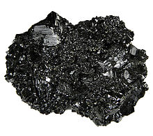
The slow cooling gave time for crystals to form in the granite which are large enough to see with the naked eye, giving it a granular appearance.
[28] The chemistry and mineralogy of the granites vary from one location to another, but they are all classified on the Chappell & White classification as being S-type, which means that they are ultimately derived from sedimentary rock protolith.
Li-mica granite forms a less common type found only in the St. Austell pluton and some smaller intrusions.
This tourmalinisation occurred during the late stages of cooling of the granite, as feldspar and mica were partly replaced by tourmaline.
The granites are highly enriched in lithium, boron, caesium and uranium and moderately so in fluorine, gallium, germanium, rubidium, tin, tantalum, tungsten and thallium.
The early group of granites contain more aluminium than the later set and have steeper slopes on plots of cerium against yttrium.
Fluids rich in these have strongly affected the country rock and locally the granites themselves in a process called metasomatism.
The first phase recognised is alkali metasomatism (where alkaline components are enhanced), which occurred within and at the margins of the granite.
[5] The mineral deposits are associated with multiple lodes and fractures that dip steeply and cut across both the granites and the country rocks.
[10] Large economic deposits of china clay are found in places across the south-west peninsula, in particular Lee Moor on the western edge of Dartmoor and the St Austell district.
[10] One theory is that the kaolinization resulted from intense supergene weathering in a tropical to warm climate during the Cretaceous to Cenozoic, based on studies of D/H and 18O/16O ratios.