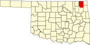
Craig County, Oklahoma
[2] The county was organized in 1907, shortly before statehood, and named for Granville Craig, a prominent Cherokee farmer who lived in the Bluejacket area.
Members of the Cherokee Nation began moving into the area during the 1830s, particularly after Indian Removal by the US government, which forced them on the "Trail of Tears" to west of the Mississippi River, when they were given land by the United States in exchange for their territory in the Southeast.
[3] Between 1867 and 1870, the U. S. government moved the Shawnee and Delaware tribes into this area from Kansas, another section of Indian Territory.
Then the area was assigned as part of the Delaware and Cooweescoowee districts of the Cherokee Nation, Indian Territory, after the US government had made new treaties with the tribes that had allied with the Confederacy during the Civil War.
It was named for Granville Craig, a prominent Cherokee farmer of mixed race who had property near Bluejacket.
[4] The county lies in the Osage Plains, on the western edge of the Ozark Plateau, and drains into several tributaries of the Neosho River.
[13] The Big Cabin School District covered parts of the county until its 1992 dissolution.
[14] The following sites in Craig County are listed on the National Register of Historic Places: