Dakota County, Minnesota
The county was the site of historical events at Mendota that defined the state's future, including providing materials for the construction of Fort Snelling across the river and the signing of the Treaty of Traverse des Sioux which ceded land from the native Dakota nation for the Minnesota Territory.
The county's history was initially tied to the confluence of the Mississippi and Minnesota Rivers, both strategically important for United States expansion and as the convergence of the Dakota and Ojibwe nations who regarded the site as sacred.
Influence shifted westward during the post-World War II settlement boom when Interstate 35 connected the western half of the county to Minneapolis and Saint Paul and bedroom communities grew.
[4][6] In the 1600s, Mdewakanton Dakota fled their ancestral home of Mille Lacs Lake in northern Minnesota in response to westward expansion of the Ojibwe nation.
[11] According to Dakota tradition, their ancestors pushed out the Iowa who were found settled at the mouth of the Minnesota River.
[15] In 1819, on what is now Picnic Island on the south bank of the Minnesota River, Colonel Henry Leavenworth built a stockade fort called "St. Peter's Cantonment" or "New Hope," where materials were assembled for the construction of Fort Snelling to be built on the bluff on the north bank.
Henry Hastings Sibley later built the first stone house in Minnesota in 1836, overlooking Fort Snelling.
[20] By the time Minnesota achieved statehood in 1858, power and influence had shifted from Mendota, across the rivers to Saint Paul and Minneapolis.
[23] The rest of the county remained agricultural during the boom of milling activity north of the Minnesota River due to lack of bridge connections.
Rail access came in 1866 via the Chicago, St. Paul, Minneapolis, and Omaha Railroad which shipped grain to millers.
[24] The Minneapolis St. Paul Rochester and Dubuque Electric Traction Company line in 1905 (now the Dan Patch Corridor), was primary for passengers going to resorts in Burnsville and Lakeville.
[25] By the 1950s, population growth shifted to western Dakota County, which had been predominantly Irish and Scottish extending southward toward the Scandinavians of Southern Minnesota.
[26][27] As population pressures expanded south from Minneapolis and Bloomington, the completion of Interstate 35W and 35E brought about major construction in the post-World War II period, turning villages into cities within 20 years.
Burnsville, Apple Valley, Eagan, and Lakeville brought over 200,000 people into the county by the end of the century.
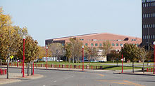
Dakota County is home to the state's largest school districts and some of the highest paid Superintendents.
Though linked with the state's capital for much of history via rail, Dakota County owes much of its current growth to the expansion of Minneapolis' population which accelerated during the post-World War II boom era of the 1960s.
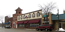
[47][48] In contrast, the southern part of Dakota County reflects the rural past with small towns such as Farmington, Coates, Vermillion, Hampton, Randolph, and Miesville where street grids and housing dating from the early 20th century can be found.
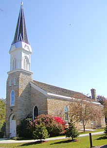
The City of Hastings, the county seat, lies on both banks of the Mississippi River and was linked historically and physically by rail to the growing influence of the state's capital, Saint Paul.
[clarification needed] Though all of Dakota County is considered part of the metropolitan area and open to major development, the county government has steadily preserved farmland and continues to acquire new permanent natural lands in the southern townships.